ℹ️ Skipped - page is already crawled
| Filter | Status | Condition | Details |
|---|---|---|---|
| HTTP status | PASS | download_http_code = 200 | HTTP 200 |
| Age cutoff | PASS | download_stamp > now() - 6 MONTH | 0.1 months ago |
| History drop | PASS | isNull(history_drop_reason) | No drop reason |
| Spam/ban | PASS | fh_dont_index != 1 AND ml_spam_score = 0 | ml_spam_score=0 |
| Canonical | PASS | meta_canonical IS NULL OR = '' OR = src_unparsed | Not set |
| Property | Value |
|---|---|
| URL | https://www.nps.gov/viis/learn/viis-hurricane-recovery.htm |
| Last Crawled | 2026-04-15 23:54:22 (2 days ago) |
| First Indexed | 2017-12-09 03:54:58 (8 years ago) |
| HTTP Status Code | 200 |
| Meta Title | VIIS Hurricane Recovery - Virgin Islands National Park (U.S. National Park Service) |
| Meta Description | null |
| Meta Canonical | null |
| Boilerpipe Text | Follow Virgin Islands National Park and Virgin Islands Coral Reef National Monument as we recover from two devastating hurricanes that ravaged St. John and the rest of the Leeward Islands in 2017. Hurricane Irma struck St. John on September 6, 2017, and changed the island forever.
Once the storm passed, the worst was yet to come. Venturing outside for the first time and seeing the destruction was impossible to comprehend. Every leaf was stripped from the island. All the telephone poles were down. Most of the island trees had been toppled and many were tangled with the poles and wires.
Work and evidence of recovery had already started when the news of Hurricane Maria baring down on us brought everyone to their knees. The Navy, National Guard, and many other groups who had come to assist were evacuated.
After Hurricane Maria brought further rain,wind and destruction, there was nothing to do but move forward, one step at a time. Virgin Islanders, and especially St. Johnians, are a courageous lot!
We have compiled articles, vides and images so that you can follow our progress.
Left image
Pre storm Meandrina in mangrove roots, filled with fish, sponges and other creatures.
Credit: Caroline Rogers
Right image
Post storm Meandrina, notice the lack of fish, sponges and the tumbled coral.
Credit: Caroline Rogers
Showing results 1-7 of 7
We discovered a little white house on the beach, one of the oldest standing structures in the Virgin Island’s dating back to the 1600s. Having objects made by the people and cultures that came before us on display, provided a timeline of physical proof of the islands' rich past, inspiring a new appreciation for our heritage in both an older and younger generation and a desire to preserve these treasures for all to enjoy.
These new pavilions are being installed through the support of the Friends of Virgin Islands National Park; they replace the structures destroyed by Hurricane Irma with three smaller pavilions that will be more resilient to storms.
Dr. Caroline Rogers and Jeff Miller gave presentations to the public on April 7, 2018. The presentations provided information on the damage caused to the coral reefs, marine life and mangroves in the Virgin Islands National Park and Coral Reef National Monument. Find out here what is recovering and what may not.
I am pleased to say that the check was cut last night and the letter has been sent to the Navy. The agreement has yet to be signed, but soon the Navy and their contractor will set sail from the states to St John. It will take a while for them to get here with all their resources, but once they are close, we will be posting regular updates on our Facebook page and communicating with affected boat owners.
Virgin Islands National Park wants to thank Great Smoky Mountain Trail Crew for their tremendous work in rehabilitate the Reef Bay Trail. In addition to clearing the trail much of it had to be reconstructed or redirected.
Lineman will be installing power poles and line in the Lameshur area over the next two weeks.
St. John, Virgin Islands – Virgin Islands National Park today declared all roads, trails and beaches open at the park, 105 days after Hurricane Irma ravaged the island of St. John.
It was hoped that St. John would have 90% power by Christmas.
We think the goal has been reached!! We have even better news: they are now running power lines to the remote areas of St. John.
What's Open?
All beaches, trails and roads are open!!
Fifth Beach Reopens at Virgin Islands National Park
Left image
Maho Bay post Hurricane Irma
Credit: Christy McManus
Right image
Maho Bay Opens
Credit: NPS photo
The Fate of Cinnamon Bay Archaeology Museum
December 4, 2017
The requested video is no longer available.
Trunk Bay November 25, 2017
Trunk Bay Open
November 21, 2017
Trunk Bay on St. John is now open as well as Christiansted National Historic Site and Buck Island Reef National Monument over on St. Croix.
Left image
Boats in Water Creek Pre Irma
Credit: Photo by Christy McManus
Right image
Boats in Water Creek Post Irma
Credit: Photo by Christy McManus
November 18, 2017
We are delighted to announce that Hawksnest Beach and Honeymoon Beach are officially open! Vault toilets or port-o-potties are in place. A huge amount of debris was removed from the beaches themselves and park divers removed submerged debris from the swim areas. Even so, continue to be cautious when swimming anywhere in park waters. As you well know, a lot of "stuff" ended up blowing into the water around here!
NPS Photo/Mike Johnson
What's Happening in the water?
November 11, 2017
Think scuba divers have a glamorous job? When most people hear about National Park Service divers at Virgin Islands National Park, they envision the tropical recreational dives that showcase coral and fish. While this underwater scenery exists, and scientific dives are conducted for natural resource monitoring and protection; much of the diving that occurs is to do preventative and repair maintenance on the over 400 buoys that are our responsibility. Some serve as aids to navigation that prevent boaters from running aground, marking navigational channels, and others provide a mooring space that prevents damage to coral and reefs.
Divers have been resetting the seven yellow (special informational) buoys around Johnson’s Reef. These markers prevent damage to both the reef and to vessels. Each connects to a 4,000 pound concrete block set on the seafloor. Impacted by both hurricanes Irma and Maria, several buoys were detached and washed ashore. Other buoys were hit with so much force; they lifted the concrete blocks and were moved off their anchoring. Divers used airbags to lift the blocks and relocate them in the correct location and then reattached the buoys.
Dive teams have successfully made the repairs to these seven buoys and are continuing the long process of visually inspecting the remaining buoys; in addition to looking for submerged debris in areas along the beaches.
NPS Photo/Mike Johnson
November 10, 2017
Happy Veteran’s Day
from Virgin Islands National Park! American citizens since 1927, residents of the US Virgin Islands serve in all branches of the U.S. Military. Thank you to the veterans on the Virgin Islands staff as well as the veterans on the Incident Management Team who are helping with the hurricane recovery work!
NPS Photo
Assessing Historic Sites
November 8, 2017
Besides being blessed with an abundance of natural beauty, the islands have a rich cultural history.The ancient Taino people, the Europeans with dreams of wealth, and the enslaved Africans who built the homes, did the work, and then demanded and won their freedom, have all left an imprint on the land.
Archeologists from the NPS’ Southeast Archeological Center, Biscayne National Park, and Rock Creek Park have been on the ground at Virgin Islands National Park conducting assessments of the archeological and historical sites following Hurricanes Irma and Maria. To date the team has visited over 50% of all the sites, noting damages to the unique cultural heritage of St. John that was brought by the storms. While some sites have sustained damaged, others were untouched.
Left image
Cinnamon Bay Lab 2016
Credit: Photo by Anne Finney
Right image
Cinnamon Bay Lab Post Hurricanes Irma & Maria
Credit: Photo by Christy McManus
NPS Photo/Christy McManus
Another Possible Storm
September 16, 2017
The National Hurricane Center announced the horrifying news that there was another storm brewing and it was headed towards the islands. For everyone in the islands this was just unimaginable, two hurricanes in one season.
"
The disturbance is expected to intensify and will likely bring tropical storm and hurricane conditions as well as flooding rainfall to portions of the Lesser Antilles early next week. These conditions could also spread into the Virgin Islands and Puerto Rico by mid week. Interests in these areas should monitor the progress of this system and follow any advice given by local officials.
"
For the first time the islanders were asked to evacuate. People were evacuated to San Juan or St. Croix in an attempt to get them out of the region.
By September 18th the islands were under a tropical storm Watch. At this time the only communication was one radio station and word of mouth.
Photo by Alanna Smith
Day before Irma Demolishes St. John
September 5, 2017
Note: Hurricane Irma due to hit the island within 12 hours.
The hatches are battened! Boats are tied up, windows are shuttered, and we are waiting on Irma.
Please stay safe everyone!
Alert for Hurricane Irma
September 4, 2017
A hurricane watch has been issued for Puerto Rico and US Virgin Islands.
STORM INFORMATION:- About 840 miles east of San Juan PR or about 770 miles east of Saint Thomas VI- 16.8N 53.3W- Storm Intensity 120 mph- Movement West-southwest or 255 degrees at 14 mph
SITUATION OVERVIEW--------------
Irma is expected to remain as a major hurricane as it approachesPuerto Rico and the U.S Virgin Islands Wednesday afternoon into Thursday. Irma could cause dangerous winds, storm surge and rainfall impacts across the local isles. Hurricane Force winds are possible across Northern U.S. Virgin Islands, Culebra and Northeast Puerto Rico with strong tropical force winds likely. The rest of the area likely to experience tropical storm force winds. Wind gusts with hurricane forcewind are likely at higher elevations. The earliest reasonable time of tropical storm winds is Wednesday morning. Rainfall accumulations between 4 to 8 with isolated amounts over 10 inches likely Wednesday through Thursday.
Photo Gallery
Irma and Maria
17 Images
Irma and Maria the two category 5 hurricanes that tore through Virgin Islands National Park and the rest of the Caribbean in 2017.
Reef Bay Trail Section
Left image
Reef Bay Trail Section Post Irma
Credit: Eric Wood
Right image
Reef Bay Trail Section Final Cleanup
Credit: Eric Wood
Reef Bay Factory
Left image
Reef Bay Factory Post Irma
Credit: Eric Wood
Right image
Reef Bay Factory Post Irma Final Cleanup
Credit: Eric Wood
Showing results 1-6 of 6
Narrow By Location:
We discovered a little white house on the beach, one of the oldest standing structures in the Virgin Island’s dating back to the 1600s. Having objects made by the people and cultures that came before us on display, provided a timeline of physical proof of the islands' rich past, inspiring a new appreciation for our heritage in both an older and younger generation and a desire to preserve these treasures for all to enjoy.
These new pavilions are being installed through the support of the Friends of Virgin Islands National Park; they replace the structures destroyed by Hurricane Irma with three smaller pavilions that will be more resilient to storms.
Corals do not typically thrive in mangrove environments. However, corals are growing on and near the prop roots of red mangrove trees in Hurricane Hole, an area within the Virgin Islands Coral Reef National Monument under the protection of the US Park Service in St. John, US Virgin Islands. This review summarizes current knowledge of the remarkable biodiversity of this area.
Information on the damage caused by Hurricanes Irma and Maria, and the recovery process of the mangroves and other habitats in Hurricane Hole.
Dr. Caroline Rogers and Jeff Miller gave presentations to the public on April 7, 2018. The presentations provided information on the damage caused to the coral reefs, marine life and mangroves in the Virgin Islands National Park and Coral Reef National Monument. Find out here what is recovering and what may not.
Virgin Islands National Park wants to thank Great Smoky Mountain Trail Crew for their tremendous work in rehabilitate the Reef Bay Trail. In addition to clearing the trail much of it had to be reconstructed or redirected. |
| Markdown | 
An official website of the United States government
Here's how you know
Here's how you know

**Official websites use .gov**
A **.gov** website belongs to an official government organization in the United States.

**Secure .gov websites use HTTPS**
A **lock** ( Locked padlock icon) or **https://** means you've safely connected to the .gov website. Share sensitive information only on official, secure websites.
- [Skip to global NPS navigation](https://www.nps.gov/viis/learn/viis-hurricane-recovery.htm#GlobalNav-toggle)
- [Skip to this park navigation](https://www.nps.gov/viis/learn/viis-hurricane-recovery.htm#LocalNav-desktop-nav)
- [Skip to the main content](https://www.nps.gov/viis/learn/viis-hurricane-recovery.htm#main)
- [Skip to this park information section](https://www.nps.gov/viis/learn/viis-hurricane-recovery.htm#ParkFooter)
- [Skip to the footer section](https://www.nps.gov/viis/learn/viis-hurricane-recovery.htm#GlobalFooter)
[ National Park Service](https://www.nps.gov/)
[Search](https://www.nps.gov/viis/learn/viis-hurricane-recovery.htm#GlobalFooterSearchInput)
# Open Menu Close Menu
## Explore This Park
- [Park Home](https://www.nps.gov/viis/index.htm)
- [Plan Your Visit](https://www.nps.gov/viis/planyourvisit/index.htm)
Toggle submenu for Plan Your Visit
- [Frequently Asked Questions](https://www.nps.gov/viis/planyourvisit/frequently-asked-questions.htm)
- [Ranger Programs & Tours](https://www.nps.gov/viis/planyourvisit/rangerguidedtours.htm)
- [Basic Information](https://www.nps.gov/viis/planyourvisit/basicinfo.htm)
Toggle submenu for Basic Information
- [Operating Hours & Seasons](https://www.nps.gov/viis/planyourvisit/hours.htm)
- [Fees & Passes](https://www.nps.gov/viis/planyourvisit/fees.htm)
- [Current Conditions](https://www.nps.gov/viis/planyourvisit/conditions.htm)
- [Permits & Reservations](https://www.nps.gov/viis/planyourvisit/permitsandreservations.htm)
- [Pets](https://www.nps.gov/viis/planyourvisit/pets.htm)
- [Directions & Transportation](https://www.nps.gov/viis/planyourvisit/directions.htm)
Toggle submenu for Directions & Transportation
- [Maps](https://www.nps.gov/viis/planyourvisit/maps.htm)
- [Getting Around](https://www.nps.gov/viis/planyourvisit/gettingaround.htm)
- [Public Transportation](https://www.nps.gov/viis/planyourvisit/publictransportation.htm)
- [Eating & Sleeping](https://www.nps.gov/viis/planyourvisit/eatingsleeping.htm)
Toggle submenu for Eating & Sleeping
- [Camping](https://www.nps.gov/viis/planyourvisit/camping.htm)
- [Places To Go](https://www.nps.gov/viis/planyourvisit/placestogo.htm)
- [Things To Do](https://www.nps.gov/viis/planyourvisit/things2do.htm)
Toggle submenu for Things To Do
- [Fishing](https://www.nps.gov/viis/planyourvisit/viis-fishing-info.htm)
- [Snorkeling](https://www.nps.gov/viis/planyourvisit/snorkeling.htm)
- [Boating](https://www.nps.gov/viis/planyourvisit/boating-information.htm)
Toggle submenu for Boating
- [Interactive Marine Map](https://www.nps.gov/viis/planyourvisit/virgin-islands-marine-visitor-use-information.htm)
- [Hiking](https://www.nps.gov/viis/planyourvisit/hiking-in-viis.htm)
- [Calendar](https://www.nps.gov/viis/planyourvisit/calendar.htm)
- [Safety](https://www.nps.gov/viis/planyourvisit/safety.htm)
- [Accessibility](https://www.nps.gov/viis/planyourvisit/accessibility.htm)
- [Brochures](https://www.nps.gov/viis/planyourvisit/brochures.htm)
- [Learn About the Park](https://www.nps.gov/viis/learn/index.htm)
Toggle submenu for Learn About the Park
- [News](https://www.nps.gov/viis/learn/news/index.htm)
Toggle submenu for News
- [News Releases](https://www.nps.gov/viis/learn/news/newsreleases.htm)
- [Photos & Multimedia](https://www.nps.gov/viis/learn/photosmultimedia/index.htm)
Toggle submenu for Photos & Multimedia
- [Park Videos](https://www.nps.gov/viis/learn/photosmultimedia/videos.htm)
- [Photo Gallery](https://www.nps.gov/viis/learn/photosmultimedia/photo-gallery.htm)
- [Webcams](https://www.nps.gov/viis/learn/photosmultimedia/webcams.htm)
- [History & Culture](https://www.nps.gov/viis/learn/historyculture/index.htm)
Toggle submenu for History & Culture
- [Archeology](https://www.nps.gov/viis/learn/historyculture/archeology.htm)
Toggle submenu for Archeology
- [Timeline of St. John History](https://www.nps.gov/viis/learn/timeline.htm)
- [People](https://www.nps.gov/viis/learn/historyculture/people.htm)
Toggle submenu for People
- [Modern Era](https://www.nps.gov/viis/learn/historyculture/modern-era.htm)
- [African Diaspora](https://www.nps.gov/viis/learn/historyculture/african-diaspora.htm)
- [Indigenous Peoples](https://www.nps.gov/viis/learn/historyculture/indigenous-peoples.htm)
- [Places](https://www.nps.gov/viis/learn/historyculture/places.htm)
- [Preservation](https://www.nps.gov/viis/learn/historyculture/preservation.htm)
- [Nature](https://www.nps.gov/viis/learn/nature/index.htm)
Toggle submenu for Nature
- [Animals](https://www.nps.gov/viis/learn/nature/animals.htm)
Toggle submenu for Animals
- [Sea Turtles](https://www.nps.gov/viis/learn/nature/turtles-of-the-virgin-islands.htm)
- [Birds](https://www.nps.gov/viis/learn/nature/bird.htm)
- [Coral](https://www.nps.gov/viis/learn/nature/coral.htm)
- [Sharks and Rays](https://www.nps.gov/viis/learn/nature/virgin-islands-sharks-and-rays.htm)
- [Fish](https://www.nps.gov/viis/learn/nature/fish.htm)
- [Insects, Spiders, Centipedes, Millipedes](https://www.nps.gov/viis/learn/nature/insects.htm)
- [Mammals](https://www.nps.gov/viis/learn/nature/mammals.htm)
- [Plants](https://www.nps.gov/viis/learn/nature/plants.htm)
Toggle submenu for Plants
- [Trees and Plants](https://www.nps.gov/viis/learn/nature/vi_trees-plants.htm)
- [Seagrass](https://www.nps.gov/viis/learn/nature/seagrass.htm)
- [Marine Plants / Algae](https://www.nps.gov/viis/learn/nature/marineplants.htm)
- [Mangroves](https://www.nps.gov/viis/learn/nature/mangroves.htm)
- [Environmental Factors](https://www.nps.gov/viis/learn/nature/environmentalfactors.htm)
Toggle submenu for Environmental Factors
- [Air Quality](https://www.nps.gov/viis/learn/nature/airquality.htm)
- [Geologic Activity](https://www.nps.gov/viis/learn/nature/geologic-activity.htm)
- [Nonnative Species](https://www.nps.gov/viis/learn/nature/nonnativespecies.htm)
- [Earthquakes & Tsunamis](https://www.nps.gov/viis/learn/nature/earthquakes-and-tsunamis.htm)
- [Weather](https://www.nps.gov/viis/learn/nature/weather.htm)
- [Science & Research](https://www.nps.gov/viis/learn/scienceresearch.htm)
- [Kids & Youth](https://www.nps.gov/viis/learn/kidsyouth/index.htm)
Toggle submenu for Kids & Youth
- [YCC Adventures](https://www.nps.gov/viis/learn/kidsyouth/ycc-adventures.htm)
- [Junior Ranger](https://www.nps.gov/viis/learn/kidsyouth/beajuniorranger.htm)
- [Park Fun](https://www.nps.gov/viis/learn/kidsyouth/parkfun.htm)
- [Management](https://www.nps.gov/viis/learn/management/index.htm)
Toggle submenu for Management
- [Hurricane Recovery Journal](https://www.nps.gov/viis/learn/viis-hurricane-recovery.htm)
- [Caneel Bay News](https://www.nps.gov/viis/caneelbay.htm)
Toggle submenu for Caneel Bay News
- [Caneel Bay FAQs](https://www.nps.gov/viis/learn/management/caneel-bay-faqs.htm)
- [Environmental Contamination Investigation](https://www.nps.gov/viis/contamination.htm)
- [Our Staff & Offices](https://www.nps.gov/viis/learn/management/offices-staff.htm)
- [Laws & Policies](https://www.nps.gov/viis/learn/management/lawsandpolicies.htm)
Toggle submenu for Laws & Policies
- [Superintendent's Compendium](https://www.nps.gov/viis/learn/management/compendium.htm)
- [Drones](https://www.nps.gov/viis/learn/management/drones.htm)
- [Firearms](https://www.nps.gov/viis/learn/management/firearmpolicy.htm)
- [Publications](https://www.nps.gov/viis/learn/nature/publications.htm)
- [Get Involved](https://www.nps.gov/viis/getinvolved/index.htm)
Toggle submenu for Get Involved
- [Donate](https://www.nps.gov/viis/getinvolved/donate.htm)
- [Volunteer](https://www.nps.gov/viis/getinvolved/volunteer.htm)
- [Do Business With Us](https://www.nps.gov/viis/getinvolved/dobusinesswithus.htm)
Toggle submenu for Do Business With Us
- [Request for Qualifications- Caneel Bay](https://www.nps.gov/viis/getinvolved/caneel-bay-request-for-qualifications-10-4-24.htm)
- [CUA Cover Letter](https://www.nps.gov/viis/getinvolved/cua-cover-letter.htm)
- [Support Your Park](https://www.nps.gov/viis/getinvolved/supportyourpark/index.htm)
Toggle submenu for Support Your Park
- [Park Store](https://www.nps.gov/viis/getinvolved/supportyourpark/park-store.htm)
- [Join Our Friends](https://www.nps.gov/viis/getinvolved/supportyourpark/joinourfriends.htm)
## Explore the National Park Service
- [Plan Your Visit](https://www.nps.gov/planyourvisit/index.htm)
Toggle submenu for Plan Your Visit
- [Find a Park](https://www.nps.gov/findapark/index.htm)
- [Events](https://www.nps.gov/planyourvisit/event-search.htm)
- [Passes](https://www.nps.gov/planyourvisit/passes.htm)
- [Trip Ideas](https://www.nps.gov/planyourvisit/trip-ideas.htm)
- [Learn & Explore](https://www.nps.gov/learnandexplore/index.htm)
Toggle submenu for Learn & Explore
- [About Us](https://www.nps.gov/aboutus/index.htm)
- [Discover History](https://www.nps.gov/history/index.htm)
- [Explore Nature](https://www.nps.gov/nature/index.htm)
- [Kids](https://www.nps.gov/kids/index.htm)
- [Educators](https://www.nps.gov/teachers/index.htm)
- [News](https://www.nps.gov/aboutus/news/index.htm)
- [Photos & Multimedia](https://www.nps.gov/aboutus/news/photosmultimedia.htm)
- [Explore by Topic](https://www.nps.gov/learnandexplore/explore-by-topic.htm)
- [Get Involved](https://www.nps.gov/getinvolved/index.htm)
Toggle submenu for Get Involved
- [Donate](https://www.nps.gov/getinvolved/donate.htm)
- [Partner](https://www.nps.gov/getinvolved/partner.htm)
- [Volunteer](https://www.nps.gov/getinvolved/volunteer.htm)
- [Work for Us](https://www.nps.gov/aboutus/workwithus.htm)
- [Community Resources](https://www.nps.gov/getinvolved/communities.htm)
- [Search for parks by activity or topic](https://www.nps.gov/findapark/advanced-search.htm)
## Exiting nps.gov
Cancel
[Virgin Islands](https://www.nps.gov/viis/)
National Park Virgin Islands
- [Park Home](https://www.nps.gov/viis/index.htm)
- [Plan Your Visit](https://www.nps.gov/viis/planyourvisit/index.htm)
- [Frequently Asked Questions](https://www.nps.gov/viis/planyourvisit/frequently-asked-questions.htm)
- [Ranger Programs & Tours](https://www.nps.gov/viis/planyourvisit/rangerguidedtours.htm)
- [Basic Information](https://www.nps.gov/viis/planyourvisit/basicinfo.htm)
- [Operating Hours & Seasons](https://www.nps.gov/viis/planyourvisit/hours.htm)
- [Fees & Passes](https://www.nps.gov/viis/planyourvisit/fees.htm)
- [Current Conditions](https://www.nps.gov/viis/planyourvisit/conditions.htm)
- [Permits & Reservations](https://www.nps.gov/viis/planyourvisit/permitsandreservations.htm)
- [Pets](https://www.nps.gov/viis/planyourvisit/pets.htm)
- [Directions & Transportation](https://www.nps.gov/viis/planyourvisit/directions.htm)
- [Maps](https://www.nps.gov/viis/planyourvisit/maps.htm)
- [Getting Around](https://www.nps.gov/viis/planyourvisit/gettingaround.htm)
- [Public Transportation](https://www.nps.gov/viis/planyourvisit/publictransportation.htm)
- [Eating & Sleeping](https://www.nps.gov/viis/planyourvisit/eatingsleeping.htm)
- [Camping](https://www.nps.gov/viis/planyourvisit/camping.htm)
- [Places To Go](https://www.nps.gov/viis/planyourvisit/placestogo.htm)
- [Things To Do](https://www.nps.gov/viis/planyourvisit/things2do.htm)
- [Fishing](https://www.nps.gov/viis/planyourvisit/viis-fishing-info.htm)
- [Snorkeling](https://www.nps.gov/viis/planyourvisit/snorkeling.htm)
- [Boating](https://www.nps.gov/viis/planyourvisit/boating-information.htm)
- [Interactive Marine Map](https://www.nps.gov/viis/planyourvisit/virgin-islands-marine-visitor-use-information.htm)
- [Hiking](https://www.nps.gov/viis/planyourvisit/hiking-in-viis.htm)
- [Calendar](https://www.nps.gov/viis/planyourvisit/calendar.htm)
- [Safety](https://www.nps.gov/viis/planyourvisit/safety.htm)
- [Accessibility](https://www.nps.gov/viis/planyourvisit/accessibility.htm)
- [Brochures](https://www.nps.gov/viis/planyourvisit/brochures.htm)
- [Learn About the Park](https://www.nps.gov/viis/learn/index.htm)
- [News](https://www.nps.gov/viis/learn/news/index.htm)
- [News Releases](https://www.nps.gov/viis/learn/news/newsreleases.htm)
- [Photos & Multimedia](https://www.nps.gov/viis/learn/photosmultimedia/index.htm)
- [Park Videos](https://www.nps.gov/viis/learn/photosmultimedia/videos.htm)
- [Photo Gallery](https://www.nps.gov/viis/learn/photosmultimedia/photo-gallery.htm)
- [Webcams](https://www.nps.gov/viis/learn/photosmultimedia/webcams.htm)
- [History & Culture](https://www.nps.gov/viis/learn/historyculture/index.htm)
- [Archeology](https://www.nps.gov/viis/learn/historyculture/archeology.htm)
- [Timeline of St. John History](https://www.nps.gov/viis/learn/timeline.htm)
- [People](https://www.nps.gov/viis/learn/historyculture/people.htm)
- [Modern Era](https://www.nps.gov/viis/learn/historyculture/modern-era.htm)
- [African Diaspora](https://www.nps.gov/viis/learn/historyculture/african-diaspora.htm)
- [Indigenous Peoples](https://www.nps.gov/viis/learn/historyculture/indigenous-peoples.htm)
- [Places](https://www.nps.gov/viis/learn/historyculture/places.htm)
- [Preservation](https://www.nps.gov/viis/learn/historyculture/preservation.htm)
- [Nature](https://www.nps.gov/viis/learn/nature/index.htm)
- [Animals](https://www.nps.gov/viis/learn/nature/animals.htm)
- [Sea Turtles](https://www.nps.gov/viis/learn/nature/turtles-of-the-virgin-islands.htm)
- [Birds](https://www.nps.gov/viis/learn/nature/bird.htm)
- [Coral](https://www.nps.gov/viis/learn/nature/coral.htm)
- [Sharks and Rays](https://www.nps.gov/viis/learn/nature/virgin-islands-sharks-and-rays.htm)
- [Fish](https://www.nps.gov/viis/learn/nature/fish.htm)
- [Insects, Spiders, Centipedes, Millipedes](https://www.nps.gov/viis/learn/nature/insects.htm)
- [Mammals](https://www.nps.gov/viis/learn/nature/mammals.htm)
- [Plants](https://www.nps.gov/viis/learn/nature/plants.htm)
- [Trees and Plants](https://www.nps.gov/viis/learn/nature/vi_trees-plants.htm)
- [Seagrass](https://www.nps.gov/viis/learn/nature/seagrass.htm)
- [Marine Plants / Algae](https://www.nps.gov/viis/learn/nature/marineplants.htm)
- [Mangroves](https://www.nps.gov/viis/learn/nature/mangroves.htm)
- [Environmental Factors](https://www.nps.gov/viis/learn/nature/environmentalfactors.htm)
- [Air Quality](https://www.nps.gov/viis/learn/nature/airquality.htm)
- [Geologic Activity](https://www.nps.gov/viis/learn/nature/geologic-activity.htm)
- [Nonnative Species](https://www.nps.gov/viis/learn/nature/nonnativespecies.htm)
- [Earthquakes & Tsunamis](https://www.nps.gov/viis/learn/nature/earthquakes-and-tsunamis.htm)
- [Weather](https://www.nps.gov/viis/learn/nature/weather.htm)
- [Science & Research](https://www.nps.gov/viis/learn/scienceresearch.htm)
- [Kids & Youth](https://www.nps.gov/viis/learn/kidsyouth/index.htm)
- [YCC Adventures](https://www.nps.gov/viis/learn/kidsyouth/ycc-adventures.htm)
- [Junior Ranger](https://www.nps.gov/viis/learn/kidsyouth/beajuniorranger.htm)
- [Park Fun](https://www.nps.gov/viis/learn/kidsyouth/parkfun.htm)
- [Management](https://www.nps.gov/viis/learn/management/index.htm)
- [Hurricane Recovery Journal](https://www.nps.gov/viis/learn/viis-hurricane-recovery.htm)
- [Caneel Bay News](https://www.nps.gov/viis/caneelbay.htm)
- [Caneel Bay FAQs](https://www.nps.gov/viis/learn/management/caneel-bay-faqs.htm)
- [Environmental Contamination Investigation](https://www.nps.gov/viis/contamination.htm)
- [Our Staff & Offices](https://www.nps.gov/viis/learn/management/offices-staff.htm)
- [Laws & Policies](https://www.nps.gov/viis/learn/management/lawsandpolicies.htm)
- [Superintendent's Compendium](https://www.nps.gov/viis/learn/management/compendium.htm)
- [Drones](https://www.nps.gov/viis/learn/management/drones.htm)
- [Firearms](https://www.nps.gov/viis/learn/management/firearmpolicy.htm)
- [Publications](https://www.nps.gov/viis/learn/nature/publications.htm)
- [Get Involved](https://www.nps.gov/viis/getinvolved/index.htm)
- [Donate](https://www.nps.gov/viis/getinvolved/donate.htm)
- [Volunteer](https://www.nps.gov/viis/getinvolved/volunteer.htm)
- [Do Business With Us](https://www.nps.gov/viis/getinvolved/dobusinesswithus.htm)
- [Request for Qualifications- Caneel Bay](https://www.nps.gov/viis/getinvolved/caneel-bay-request-for-qualifications-10-4-24.htm)
- [CUA Cover Letter](https://www.nps.gov/viis/getinvolved/cua-cover-letter.htm)
- [Support Your Park](https://www.nps.gov/viis/getinvolved/supportyourpark/index.htm)
- [Park Store](https://www.nps.gov/viis/getinvolved/supportyourpark/park-store.htm)
- [Join Our Friends](https://www.nps.gov/viis/getinvolved/supportyourpark/joinourfriends.htm)
- [Info](https://www.nps.gov/viis/planyourvisit/basicinfo.htm)
- [Alerts 3](https://www.nps.gov/viis/planyourvisit/conditions.htm)
- [Maps](https://www.nps.gov/viis/planyourvisit/maps.htm)
- [Calendar](https://www.nps.gov/viis/planyourvisit/calendar.htm)
- [Fees](https://www.nps.gov/viis/planyourvisit/fees.htm)
2 alert notifications
## Alerts In Effect
Dismiss
### Danger
- #### Flood Advisory issued April 13 at 1:13PM AST until April 13 at 3:15PM AST b
Date Posted: 4/13/2026[Alert 1, Severity danger, Flood Advisory issued April 13 at 1:13PM AST until April 13 at 3:15PM AST b]()
Cruz Bay Visitor Center and Trunk Bay Fee Station are closed as of 12:30PM 04/13/2026. Visitors should exercise extreme caution when out on roads, trails and beaches. It is advisable to find alternative activities until the weather forecast changes.
- #### Johnson's Reef Buoys are OFF STATION
Date Posted: 2/12/2026[Alert 2, Severity danger, Johnson's Reef Buoys are OFF STATION]()
The aids to navigation around Johnson's Reef are currently off station. This means that the buoys that typically guide mariners through these waters are not in their expected locations. Mariners should exercise considerable caution when navigating the waters around Johnson's Reef. The absence or misplacement of navigational aids can lead to confusion, increased risk of grounding, and potential hazards. Use updated nautical charts and GPS systems to navigate carefully through the area.
[1 more non-emergency alert notifications...](https://www.nps.gov/viis/planyourvisit/conditions.htm)
- Dismiss
- [View all alerts](https://www.nps.gov/viis/planyourvisit/conditions.htm)
#### Contact Us
1. [NPS.gov](https://www.nps.gov/)
2. [Park Home](https://www.nps.gov/viis/index.htm)
3. [Learn About the Park](https://www.nps.gov/viis/learn/index.htm)
4. [Management](https://www.nps.gov/viis/learn/management/index.htm)
5. Hurricane Recovery Journal
# Hurricane Recovery Journal
| |
|---|
| Follow Virgin Islands National Park and Virgin Islands Coral Reef National Monument as we recover from two devastating hurricanes that ravaged St. John and the rest of the Leeward Islands in 2017. Hurricane Irma struck St. John on September 6, 2017, and changed the island forever. Once the storm passed, the worst was yet to come. Venturing outside for the first time and seeing the destruction was impossible to comprehend. Every leaf was stripped from the island. All the telephone poles were down. Most of the island trees had been toppled and many were tangled with the poles and wires. Work and evidence of recovery had already started when the news of Hurricane Maria baring down on us brought everyone to their knees. The Navy, National Guard, and many other groups who had come to assist were evacuated. After Hurricane Maria brought further rain,wind and destruction, there was nothing to do but move forward, one step at a time. Virgin Islanders, and especially St. Johnians, are a courageous lot! We have compiled articles, vides and images so that you can follow our progress.   Left image Pre storm Meandrina in mangrove roots, filled with fish, sponges and other creatures. Credit: Caroline Rogers Right image Post storm Meandrina, notice the lack of fish, sponges and the tumbled coral. Credit: Caroline Rogers Showing results 1-7 of 7 Loading results... [Archaeology and Cinnamon Bay](https://www.nps.gov/articles/archaeology-cinnamon-bay.htm) Type: Article Locations: Virgin Islands National Park [](https://www.nps.gov/articles/archaeology-cinnamon-bay.htm) We discovered a little white house on the beach, one of the oldest standing structures in the Virgin Island’s dating back to the 1600s. Having objects made by the people and cultures that came before us on display, provided a timeline of physical proof of the islands' rich past, inspiring a new appreciation for our heritage in both an older and younger generation and a desire to preserve these treasures for all to enjoy. [Maho Pavilions](https://www.nps.gov/articles/maho-pavilions.htm) Type: Article Locations: Virgin Islands National Park These new pavilions are being installed through the support of the Friends of Virgin Islands National Park; they replace the structures destroyed by Hurricane Irma with three smaller pavilions that will be more resilient to storms. [The State of Our Reefs Post Irma](https://www.nps.gov/articles/the-state-of-our-reefs.htm) Type: Article Locations: Virgin Islands National Park, Virgin Islands Coral Reef National Monument [](https://www.nps.gov/articles/the-state-of-our-reefs.htm) Dr. Caroline Rogers and Jeff Miller gave presentations to the public on April 7, 2018. The presentations provided information on the damage caused to the coral reefs, marine life and mangroves in the Virgin Islands National Park and Coral Reef National Monument. Find out here what is recovering and what may not. [Status of Boat Recovery](https://www.nps.gov/viis/learn/news/status-of-hurricane-hole.htm) Type: News Locations: Virgin Islands National Park Date Released: 2018-06-22 [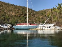](https://www.nps.gov/viis/learn/news/status-of-hurricane-hole.htm) I am pleased to say that the check was cut last night and the letter has been sent to the Navy. The agreement has yet to be signed, but soon the Navy and their contractor will set sail from the states to St John. It will take a while for them to get here with all their resources, but once they are close, we will be posting regular updates on our Facebook page and communicating with affected boat owners. [Reef Bay Trail Rehabilitation](https://www.nps.gov/articles/rb-trail-rehab.htm) Type: Article Locations: Great Smoky Mountains National Park, Virgin Islands National Park [](https://www.nps.gov/articles/rb-trail-rehab.htm) Virgin Islands National Park wants to thank Great Smoky Mountain Trail Crew for their tremendous work in rehabilitate the Reef Bay Trail. In addition to clearing the trail much of it had to be reconstructed or redirected. [Limited Access in Lameshur Area](https://www.nps.gov/viis/learn/news/access-in-lameshur.htm) Type: News Locations: Virgin Islands National Park Date Released: 2018-01-06 [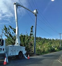](https://www.nps.gov/viis/learn/news/access-in-lameshur.htm) Lineman will be installing power poles and line in the Lameshur area over the next two weeks. [Virgin Islands National Park is All Open\!](https://www.nps.gov/viis/learn/news/viis-is-open.htm) Type: News Locations: Virgin Islands National Park Date Released: 2017-12-20 [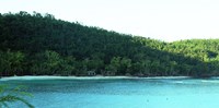](https://www.nps.gov/viis/learn/news/viis-is-open.htm) St. John, Virgin Islands – Virgin Islands National Park today declared all roads, trails and beaches open at the park, 105 days after Hurricane Irma ravaged the island of St. John. Tags: [viis irma](https://www.nps.gov/media/article-search.htm?q=VIIS%20Irma) [viis maria](https://www.nps.gov/media/article-search.htm?q=VIIS%20Maria) [Back to top](https://www.nps.gov/viis/learn/viis-hurricane-recovery.htm#main)  **It was hoped that St. John would have 90% power by Christmas.** We think the goal has been reached!! We have even better news: they are now running power lines to the remote areas of St. John. What's Open? **All beaches, trails and roads are open!\!** Fifth Beach Reopens at Virgin Islands National Park   Left image Maho Bay post Hurricane Irma Credit: Christy McManus Right image Maho Bay Opens Credit: NPS photo December 13, 2017 St. John, Virgin Islands – “Maho Bay Beach has officially reopened” announced Acting Superintendent Darrell Echols. “It doesn’t look quite the same since most of the structures were damaged beyond repair and had to be removed, but the beach itself is open for recreational use.” Divers checked the swim area for underwater debris and cleared what they found, but, as always, be cautious. Recreational buoys to moor on have all been inspected. A very few have a prominent red tag that means they need additional inspection and repair. The rest are ready for use. The North Shore road along Maho Beach was undercut on the beach side and is a single lane until repairs take place. The effected road section is delineated with orange cones, but please be cautious when driving in that area. Both parking areas have been cleared and are open. Getting the road open along Maho Bay was a challenge in the early days after Irma and Maria hit. Tangled trees and debris blocked the width of the road for long stretches. The Arrowhead Hotshot crew from Sequoia and Kings Canyon National Parks was instrumental in clearing not just the Maho Bay stretch, but the whole length of the North Shore road. To keep updated as the recovery progresses, follow us on Facebook <https://www.facebook.com/virginislandsNPS/> \-NPS- The Fate of Cinnamon Bay Archaeology Museum **December 4, 2017** **The requested video is no longer available.** 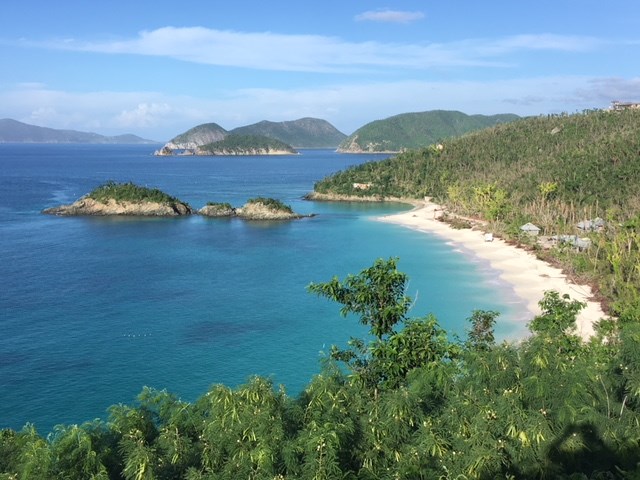 Trunk Bay November 25, 2017 Trunk Bay Open **November 21, 2017** Trunk Bay on St. John is now open as well as Christiansted National Historic Site and Buck Island Reef National Monument over on St. Croix.   Left image Boats in Water Creek Pre Irma Credit: Photo by Christy McManus Right image Boats in Water Creek Post Irma Credit: Photo by Christy McManus **November 18, 2017** We are delighted to announce that Hawksnest Beach and Honeymoon Beach are officially open! Vault toilets or port-o-potties are in place. A huge amount of debris was removed from the beaches themselves and park divers removed submerged debris from the swim areas. Even so, continue to be cautious when swimming anywhere in park waters. As you well know, a lot of "stuff" ended up blowing into the water around here\! 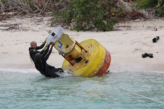 NPS Photo/Mike Johnson What's Happening in the water? **November 11, 2017** Think scuba divers have a glamorous job? When most people hear about National Park Service divers at Virgin Islands National Park, they envision the tropical recreational dives that showcase coral and fish. While this underwater scenery exists, and scientific dives are conducted for natural resource monitoring and protection; much of the diving that occurs is to do preventative and repair maintenance on the over 400 buoys that are our responsibility. Some serve as aids to navigation that prevent boaters from running aground, marking navigational channels, and others provide a mooring space that prevents damage to coral and reefs. Divers have been resetting the seven yellow (special informational) buoys around Johnson’s Reef. These markers prevent damage to both the reef and to vessels. Each connects to a 4,000 pound concrete block set on the seafloor. Impacted by both hurricanes Irma and Maria, several buoys were detached and washed ashore. Other buoys were hit with so much force; they lifted the concrete blocks and were moved off their anchoring. Divers used airbags to lift the blocks and relocate them in the correct location and then reattached the buoys. Dive teams have successfully made the repairs to these seven buoys and are continuing the long process of visually inspecting the remaining buoys; in addition to looking for submerged debris in areas along the beaches. 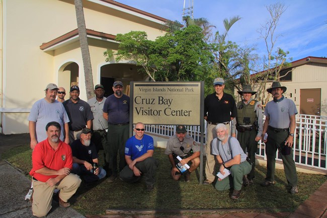 NPS Photo/Mike Johnson **November 10, 2017** Happy Veteran’s Day from Virgin Islands National Park! American citizens since 1927, residents of the US Virgin Islands serve in all branches of the U.S. Military. Thank you to the veterans on the Virgin Islands staff as well as the veterans on the Incident Management Team who are helping with the hurricane recovery work\! 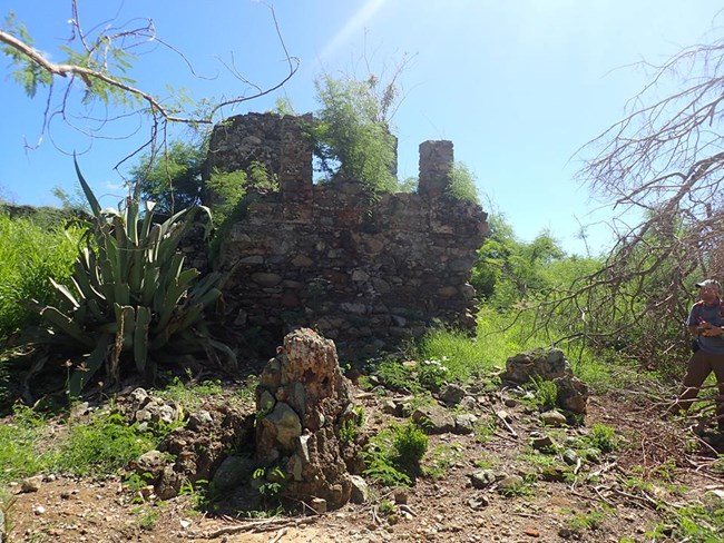 NPS Photo Assessing Historic Sites **November 8, 2017** Besides being blessed with an abundance of natural beauty, the islands have a rich cultural history.The ancient Taino people, the Europeans with dreams of wealth, and the enslaved Africans who built the homes, did the work, and then demanded and won their freedom, have all left an imprint on the land. Archeologists from the NPS’ Southeast Archeological Center, Biscayne National Park, and Rock Creek Park have been on the ground at Virgin Islands National Park conducting assessments of the archeological and historical sites following Hurricanes Irma and Maria. To date the team has visited over 50% of all the sites, noting damages to the unique cultural heritage of St. John that was brought by the storms. While some sites have sustained damaged, others were untouched.   Left image Cinnamon Bay Lab 2016 Credit: Photo by Anne Finney Right image Cinnamon Bay Lab Post Hurricanes Irma & Maria Credit: Photo by Christy McManus  NPS Photo/Christy McManus Another Possible Storm **September 16, 2017** The National Hurricane Center announced the horrifying news that there was another storm brewing and it was headed towards the islands. For everyone in the islands this was just unimaginable, two hurricanes in one season. " *The disturbance is expected to intensify and will likely bring tropical storm and hurricane conditions as well as flooding rainfall to portions of the Lesser Antilles early next week. These conditions could also spread into the Virgin Islands and Puerto Rico by mid week. Interests in these areas should monitor the progress of this system and follow any advice given by local officials.*" For the first time the islanders were asked to evacuate. People were evacuated to San Juan or St. Croix in an attempt to get them out of the region. By September 18th the islands were under a tropical storm Watch. At this time the only communication was one radio station and word of mouth.  Photo by Alanna Smith **Day before Irma Demolishes St. John** **September 5, 2017** *Note: Hurricane Irma due to hit the island within 12 hours.* The hatches are battened! Boats are tied up, windows are shuttered, and we are waiting on Irma. Please stay safe everyone\!  **Alert for Hurricane Irma** **September 4, 2017** A hurricane watch has been issued for Puerto Rico and US Virgin Islands. STORM INFORMATION:- About 840 miles east of San Juan PR or about 770 miles east of Saint Thomas VI- 16.8N 53.3W- Storm Intensity 120 mph- Movement West-southwest or 255 degrees at 14 mph SITUATION OVERVIEW-------------- Irma is expected to remain as a major hurricane as it approachesPuerto Rico and the U.S Virgin Islands Wednesday afternoon into Thursday. Irma could cause dangerous winds, storm surge and rainfall impacts across the local isles. Hurricane Force winds are possible across Northern U.S. Virgin Islands, Culebra and Northeast Puerto Rico with strong tropical force winds likely. The rest of the area likely to experience tropical storm force winds. Wind gusts with hurricane forcewind are likely at higher elevations. The earliest reasonable time of tropical storm winds is Wednesday morning. Rainfall accumulations between 4 to 8 with isolated amounts over 10 inches likely Wednesday through Thursday. [](https://www.nps.gov/media/photo/gallery.htm?pg=5710001&id=01DDB53D-C2FB-4148-9BCF-3A8CE3DE0235) Photo Gallery [Irma and Maria](https://www.nps.gov/media/photo/gallery.htm?pg=5710001&id=01DDB53D-C2FB-4148-9BCF-3A8CE3DE0235) *17 Images* Irma and Maria the two category 5 hurricanes that tore through Virgin Islands National Park and the rest of the Caribbean in 2017. [Back To The Top](https://www.nps.gov/viis/learn/viis-hurricane-recovery.htm#__topdoc__) Reef Bay Trail Section   Left image Reef Bay Trail Section Post Irma Credit: Eric Wood Right image Reef Bay Trail Section Final Cleanup Credit: Eric Wood Reef Bay trail work performed this year began at the bottom of Reef Bay Trail which suffered extreme damage from the hurricanes and a lack of maintenance. Reef Bay Factory   Left image Reef Bay Factory Post Irma Credit: Eric Wood Right image Reef Bay Factory Post Irma Final Cleanup Credit: Eric Wood Clearing around the Reef Bay Ruins involved removing downed trees and debris. Hurricane Recovery Showing results 1-6 of 6 Loading results... Virgin Islands National Park [Archaeology and Cinnamon Bay](https://www.nps.gov/articles/archaeology-cinnamon-bay.htm) Locations: Virgin Islands National Park [](https://www.nps.gov/articles/archaeology-cinnamon-bay.htm) We discovered a little white house on the beach, one of the oldest standing structures in the Virgin Island’s dating back to the 1600s. Having objects made by the people and cultures that came before us on display, provided a timeline of physical proof of the islands' rich past, inspiring a new appreciation for our heritage in both an older and younger generation and a desire to preserve these treasures for all to enjoy. Virgin Islands National Park [Maho Pavilions](https://www.nps.gov/articles/maho-pavilions.htm) Locations: Virgin Islands National Park These new pavilions are being installed through the support of the Friends of Virgin Islands National Park; they replace the structures destroyed by Hurricane Irma with three smaller pavilions that will be more resilient to storms. Virgin Islands Coral Reef National Monument [Unique Coral Community in the Mangroves of Hurricane Hole](https://www.nps.gov/articles/coral-community-in-mangroves.htm) Locations: Virgin Islands Coral Reef National Monument [](https://www.nps.gov/articles/coral-community-in-mangroves.htm) Corals do not typically thrive in mangrove environments. However, corals are growing on and near the prop roots of red mangrove trees in Hurricane Hole, an area within the Virgin Islands Coral Reef National Monument under the protection of the US Park Service in St. John, US Virgin Islands. This review summarizes current knowledge of the remarkable biodiversity of this area. Virgin Islands Coral Reef National Monument [Hurricane Hole Post 2017 storms](https://www.nps.gov/articles/hurricane-hole-post-irma-maria-recovery.htm) Locations: Virgin Islands Coral Reef National Monument [](https://www.nps.gov/articles/hurricane-hole-post-irma-maria-recovery.htm) Information on the damage caused by Hurricanes Irma and Maria, and the recovery process of the mangroves and other habitats in Hurricane Hole. [The State of Our Reefs Post Irma](https://www.nps.gov/articles/the-state-of-our-reefs.htm) Locations: Virgin Islands National Park, Virgin Islands Coral Reef National Monument [](https://www.nps.gov/articles/the-state-of-our-reefs.htm) Dr. Caroline Rogers and Jeff Miller gave presentations to the public on April 7, 2018. The presentations provided information on the damage caused to the coral reefs, marine life and mangroves in the Virgin Islands National Park and Coral Reef National Monument. Find out here what is recovering and what may not. [Reef Bay Trail Rehabilitation](https://www.nps.gov/articles/rb-trail-rehab.htm) Locations: Great Smoky Mountains National Park, Virgin Islands National Park [](https://www.nps.gov/articles/rb-trail-rehab.htm) Virgin Islands National Park wants to thank Great Smoky Mountain Trail Crew for their tremendous work in rehabilitate the Reef Bay Trail. In addition to clearing the trail much of it had to be reconstructed or redirected. Tags: [hurricane hole](https://www.nps.gov/media/article-search.htm?q=Hurricane%20Hole) [viis irma](https://www.nps.gov/media/article-search.htm?q=VIIS%20Irma) [viis maria](https://www.nps.gov/media/article-search.htm?q=VIIS%20Maria) [Back to top](https://www.nps.gov/viis/learn/viis-hurricane-recovery.htm#main) |
Last updated: November 19, 2021
### Success
Thank you. Your feedback has been received.
### Error
alert message

An official form of the United States government. Provided by [Touchpoints](https://touchpoints.app.cloud.gov/)
## Park footer
### Contact Info
#### Mailing Address:
1300 Cruz Bay Creek
St. John, VI 00830
#### Phone:
340 776-6201
Headquarters/Visitor Center phone contact Information. Visitor Center hours Monday-Thursday 8:15 to 4:00 and Friday 8:15 to 1:30.
#### [Contact Us](https://www.nps.gov/viis/contacts.htm)
### Tools
- [FAQ](https://www.nps.gov/viis/faqs.htm)
- [Site Index](https://www.nps.gov/viis/siteindex.htm)
- [Español](https://www.nps.gov/viis/espanol/index.htm)
### Stay Connected
Experience Your America.
Download the NPS app to navigate the parks on the go.
[](https://apps.apple.com/us/app/national-park-service/id1549226484) [](https://play.google.com/store/apps/details?id=gov.nps.mobileapp)
[  ](https://www.nps.gov/)
- [Accessibility](https://www.nps.gov/aboutus/accessibility.htm)
- [Privacy Policy](https://www.nps.gov/aboutus/privacy.htm)
- [FOIA](https://www.nps.gov/aboutus/foia/index.htm)
- [Notices](https://www.nps.gov/aboutus/notices.htm)
- [Contact The National Park Service](https://www.nps.gov/aboutus/contactus.htm)
- [NPS FAQ](https://www.nps.gov/aboutus/faqs.htm "National Park Service frequently asked questions")
- [No Fear Act](https://www.doi.gov/pmb/eeo/no-fear-act)
- [Disclaimer](https://www.nps.gov/aboutus/disclaimer.htm)
- [Vulnerability Disclosure Policy](https://www.nps.gov/aboutus/vulnerability-disclosure-policy.htm)
- [USA.gov](https://www.usa.gov/)
Looking for U.S. government information and services?
[Visit USA.gov](https://www.usa.gov/)
previous
next
start slideshow |
| Readable Markdown | Follow Virgin Islands National Park and Virgin Islands Coral Reef National Monument as we recover from two devastating hurricanes that ravaged St. John and the rest of the Leeward Islands in 2017. Hurricane Irma struck St. John on September 6, 2017, and changed the island forever.
Once the storm passed, the worst was yet to come. Venturing outside for the first time and seeing the destruction was impossible to comprehend. Every leaf was stripped from the island. All the telephone poles were down. Most of the island trees had been toppled and many were tangled with the poles and wires.
Work and evidence of recovery had already started when the news of Hurricane Maria baring down on us brought everyone to their knees. The Navy, National Guard, and many other groups who had come to assist were evacuated.
After Hurricane Maria brought further rain,wind and destruction, there was nothing to do but move forward, one step at a time. Virgin Islanders, and especially St. Johnians, are a courageous lot\!
We have compiled articles, vides and images so that you can follow our progress.
 
Left image
Pre storm Meandrina in mangrove roots, filled with fish, sponges and other creatures.
Credit: Caroline Rogers
Right image
Post storm Meandrina, notice the lack of fish, sponges and the tumbled coral.
Credit: Caroline Rogers
Showing results 1-7 of 7
- [](https://www.nps.gov/articles/archaeology-cinnamon-bay.htm)
We discovered a little white house on the beach, one of the oldest standing structures in the Virgin Island’s dating back to the 1600s. Having objects made by the people and cultures that came before us on display, provided a timeline of physical proof of the islands' rich past, inspiring a new appreciation for our heritage in both an older and younger generation and a desire to preserve these treasures for all to enjoy.
- These new pavilions are being installed through the support of the Friends of Virgin Islands National Park; they replace the structures destroyed by Hurricane Irma with three smaller pavilions that will be more resilient to storms.
- [](https://www.nps.gov/articles/the-state-of-our-reefs.htm)
Dr. Caroline Rogers and Jeff Miller gave presentations to the public on April 7, 2018. The presentations provided information on the damage caused to the coral reefs, marine life and mangroves in the Virgin Islands National Park and Coral Reef National Monument. Find out here what is recovering and what may not.
- [](https://www.nps.gov/viis/learn/news/status-of-hurricane-hole.htm)
I am pleased to say that the check was cut last night and the letter has been sent to the Navy. The agreement has yet to be signed, but soon the Navy and their contractor will set sail from the states to St John. It will take a while for them to get here with all their resources, but once they are close, we will be posting regular updates on our Facebook page and communicating with affected boat owners.
- [](https://www.nps.gov/articles/rb-trail-rehab.htm)
Virgin Islands National Park wants to thank Great Smoky Mountain Trail Crew for their tremendous work in rehabilitate the Reef Bay Trail. In addition to clearing the trail much of it had to be reconstructed or redirected.
- [](https://www.nps.gov/viis/learn/news/access-in-lameshur.htm)
Lineman will be installing power poles and line in the Lameshur area over the next two weeks.
- [](https://www.nps.gov/viis/learn/news/viis-is-open.htm)
St. John, Virgin Islands – Virgin Islands National Park today declared all roads, trails and beaches open at the park, 105 days after Hurricane Irma ravaged the island of St. John.

## **It was hoped that St. John would have 90% power by Christmas.**
We think the goal has been reached!! We have even better news: they are now running power lines to the remote areas of St. John.
## What's Open?
**All beaches, trails and roads are open!\!**
Fifth Beach Reopens at Virgin Islands National Park
 
Left image
Maho Bay post Hurricane Irma
Credit: Christy McManus
Right image
Maho Bay Opens
Credit: NPS photo
#### The Fate of Cinnamon Bay Archaeology Museum
**December 4, 2017**
**The requested video is no longer available.**

Trunk Bay November 25, 2017
#### Trunk Bay Open
**November 21, 2017**
Trunk Bay on St. John is now open as well as Christiansted National Historic Site and Buck Island Reef National Monument over on St. Croix.
 
Left image
Boats in Water Creek Pre Irma
Credit: Photo by Christy McManus
Right image
Boats in Water Creek Post Irma
Credit: Photo by Christy McManus
**November 18, 2017**
We are delighted to announce that Hawksnest Beach and Honeymoon Beach are officially open! Vault toilets or port-o-potties are in place. A huge amount of debris was removed from the beaches themselves and park divers removed submerged debris from the swim areas. Even so, continue to be cautious when swimming anywhere in park waters. As you well know, a lot of "stuff" ended up blowing into the water around here\!

NPS Photo/Mike Johnson
#### What's Happening in the water?
**November 11, 2017**
Think scuba divers have a glamorous job? When most people hear about National Park Service divers at Virgin Islands National Park, they envision the tropical recreational dives that showcase coral and fish. While this underwater scenery exists, and scientific dives are conducted for natural resource monitoring and protection; much of the diving that occurs is to do preventative and repair maintenance on the over 400 buoys that are our responsibility. Some serve as aids to navigation that prevent boaters from running aground, marking navigational channels, and others provide a mooring space that prevents damage to coral and reefs.
Divers have been resetting the seven yellow (special informational) buoys around Johnson’s Reef. These markers prevent damage to both the reef and to vessels. Each connects to a 4,000 pound concrete block set on the seafloor. Impacted by both hurricanes Irma and Maria, several buoys were detached and washed ashore. Other buoys were hit with so much force; they lifted the concrete blocks and were moved off their anchoring. Divers used airbags to lift the blocks and relocate them in the correct location and then reattached the buoys.
Dive teams have successfully made the repairs to these seven buoys and are continuing the long process of visually inspecting the remaining buoys; in addition to looking for submerged debris in areas along the beaches.

NPS Photo/Mike Johnson
**November 10, 2017**
Happy Veteran’s Day
from Virgin Islands National Park! American citizens since 1927, residents of the US Virgin Islands serve in all branches of the U.S. Military. Thank you to the veterans on the Virgin Islands staff as well as the veterans on the Incident Management Team who are helping with the hurricane recovery work\!

NPS Photo
#### Assessing Historic Sites
**November 8, 2017**
Besides being blessed with an abundance of natural beauty, the islands have a rich cultural history.The ancient Taino people, the Europeans with dreams of wealth, and the enslaved Africans who built the homes, did the work, and then demanded and won their freedom, have all left an imprint on the land.
Archeologists from the NPS’ Southeast Archeological Center, Biscayne National Park, and Rock Creek Park have been on the ground at Virgin Islands National Park conducting assessments of the archeological and historical sites following Hurricanes Irma and Maria. To date the team has visited over 50% of all the sites, noting damages to the unique cultural heritage of St. John that was brought by the storms. While some sites have sustained damaged, others were untouched.
 
Left image
Cinnamon Bay Lab 2016
Credit: Photo by Anne Finney
Right image
Cinnamon Bay Lab Post Hurricanes Irma & Maria
Credit: Photo by Christy McManus

NPS Photo/Christy McManus
## Another Possible Storm
**September 16, 2017**
The National Hurricane Center announced the horrifying news that there was another storm brewing and it was headed towards the islands. For everyone in the islands this was just unimaginable, two hurricanes in one season.
" *The disturbance is expected to intensify and will likely bring tropical storm and hurricane conditions as well as flooding rainfall to portions of the Lesser Antilles early next week. These conditions could also spread into the Virgin Islands and Puerto Rico by mid week. Interests in these areas should monitor the progress of this system and follow any advice given by local officials.*"
For the first time the islanders were asked to evacuate. People were evacuated to San Juan or St. Croix in an attempt to get them out of the region.
By September 18th the islands were under a tropical storm Watch. At this time the only communication was one radio station and word of mouth.

Photo by Alanna Smith
#### **Day before Irma Demolishes St. John**
**September 5, 2017**
*Note: Hurricane Irma due to hit the island within 12 hours.*
The hatches are battened! Boats are tied up, windows are shuttered, and we are waiting on Irma.
Please stay safe everyone\!

#### **Alert for Hurricane Irma**
**September 4, 2017**
A hurricane watch has been issued for Puerto Rico and US Virgin Islands.
STORM INFORMATION:- About 840 miles east of San Juan PR or about 770 miles east of Saint Thomas VI- 16.8N 53.3W- Storm Intensity 120 mph- Movement West-southwest or 255 degrees at 14 mph
SITUATION OVERVIEW--------------
Irma is expected to remain as a major hurricane as it approachesPuerto Rico and the U.S Virgin Islands Wednesday afternoon into Thursday. Irma could cause dangerous winds, storm surge and rainfall impacts across the local isles. Hurricane Force winds are possible across Northern U.S. Virgin Islands, Culebra and Northeast Puerto Rico with strong tropical force winds likely. The rest of the area likely to experience tropical storm force winds. Wind gusts with hurricane forcewind are likely at higher elevations. The earliest reasonable time of tropical storm winds is Wednesday morning. Rainfall accumulations between 4 to 8 with isolated amounts over 10 inches likely Wednesday through Thursday.
[](https://www.nps.gov/media/photo/gallery.htm?pg=5710001&id=01DDB53D-C2FB-4148-9BCF-3A8CE3DE0235)
Photo Gallery
## [Irma and Maria](https://www.nps.gov/media/photo/gallery.htm?pg=5710001&id=01DDB53D-C2FB-4148-9BCF-3A8CE3DE0235)
*17 Images*
Irma and Maria the two category 5 hurricanes that tore through Virgin Islands National Park and the rest of the Caribbean in 2017.
Reef Bay Trail Section
 
Left image
Reef Bay Trail Section Post Irma
Credit: Eric Wood
Right image
Reef Bay Trail Section Final Cleanup
Credit: Eric Wood
Reef Bay Factory
 
Left image
Reef Bay Factory Post Irma
Credit: Eric Wood
Right image
Reef Bay Factory Post Irma Final Cleanup
Credit: Eric Wood
Showing results 1-6 of 6
- [](https://www.nps.gov/articles/archaeology-cinnamon-bay.htm)
We discovered a little white house on the beach, one of the oldest standing structures in the Virgin Island’s dating back to the 1600s. Having objects made by the people and cultures that came before us on display, provided a timeline of physical proof of the islands' rich past, inspiring a new appreciation for our heritage in both an older and younger generation and a desire to preserve these treasures for all to enjoy.
- These new pavilions are being installed through the support of the Friends of Virgin Islands National Park; they replace the structures destroyed by Hurricane Irma with three smaller pavilions that will be more resilient to storms.
- [](https://www.nps.gov/articles/coral-community-in-mangroves.htm)
Corals do not typically thrive in mangrove environments. However, corals are growing on and near the prop roots of red mangrove trees in Hurricane Hole, an area within the Virgin Islands Coral Reef National Monument under the protection of the US Park Service in St. John, US Virgin Islands. This review summarizes current knowledge of the remarkable biodiversity of this area.
- [](https://www.nps.gov/articles/hurricane-hole-post-irma-maria-recovery.htm)
Information on the damage caused by Hurricanes Irma and Maria, and the recovery process of the mangroves and other habitats in Hurricane Hole.
- [](https://www.nps.gov/articles/the-state-of-our-reefs.htm)
Dr. Caroline Rogers and Jeff Miller gave presentations to the public on April 7, 2018. The presentations provided information on the damage caused to the coral reefs, marine life and mangroves in the Virgin Islands National Park and Coral Reef National Monument. Find out here what is recovering and what may not.
- [](https://www.nps.gov/articles/rb-trail-rehab.htm)
Virgin Islands National Park wants to thank Great Smoky Mountain Trail Crew for their tremendous work in rehabilitate the Reef Bay Trail. In addition to clearing the trail much of it had to be reconstructed or redirected. |
| Shard | 178 (laksa) |
| Root Hash | 15295459661596634578 |
| Unparsed URL | gov,nps!www,/viis/learn/viis-hurricane-recovery.htm s443 |