ℹ️ Skipped - page is already crawled
| Filter | Status | Condition | Details |
|---|---|---|---|
| HTTP status | PASS | download_http_code = 200 | HTTP 200 |
| Age cutoff | PASS | download_stamp > now() - 6 MONTH | 0 months ago |
| History drop | PASS | isNull(history_drop_reason) | No drop reason |
| Spam/ban | PASS | fh_dont_index != 1 AND ml_spam_score = 0 | ml_spam_score=0 |
| Canonical | PASS | meta_canonical IS NULL OR = '' OR = src_unparsed | Not set |
| Property | Value | |||||||||||||||||||||||||||
|---|---|---|---|---|---|---|---|---|---|---|---|---|---|---|---|---|---|---|---|---|---|---|---|---|---|---|---|---|
| URL | https://catescompass.com/hikes-in-the-upstate-of-south-carolina/ | |||||||||||||||||||||||||||
| Last Crawled | 2026-04-22 08:28:02 (7 hours ago) | |||||||||||||||||||||||||||
| First Indexed | 2024-01-14 01:54:40 (2 years ago) | |||||||||||||||||||||||||||
| HTTP Status Code | 200 | |||||||||||||||||||||||||||
| Content | ||||||||||||||||||||||||||||
| Meta Title | 9 Must Do Hikes in the Upstate of South Carolina | |||||||||||||||||||||||||||
| Meta Description | Want to know the best hikes in the Upstate of South Carolina? Here are my top 9 must do hikes you need to tackle the next time you're there! | |||||||||||||||||||||||||||
| Meta Canonical | null | |||||||||||||||||||||||||||
| Boilerpipe Text | Want to go hiking in Upstate South Carolina? I’ve got you covered!
Hiking in the Upstate of South Carolina is one of my favorite things to do. The area is relatively lesser known than a lot of the other hiking regions in the Southeast, but it still has a ton of incredible hikes to check out.
My all-time favorite area of the upstate is Walhalla, but other incredible areas are Table Rock State Park, Jones Gap State Park, Lake Jocassee, and Caesar’s Head State Park. Below is the list of hikes I think you must do if you visit this area of the state.
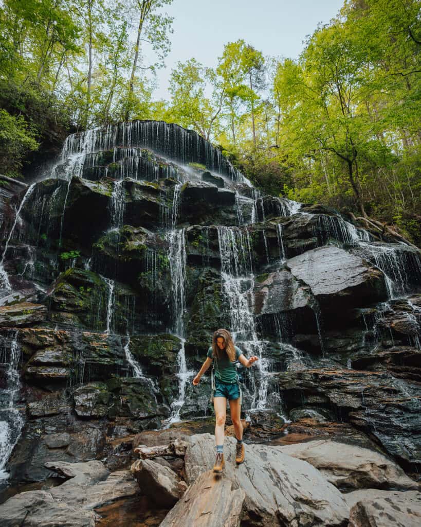
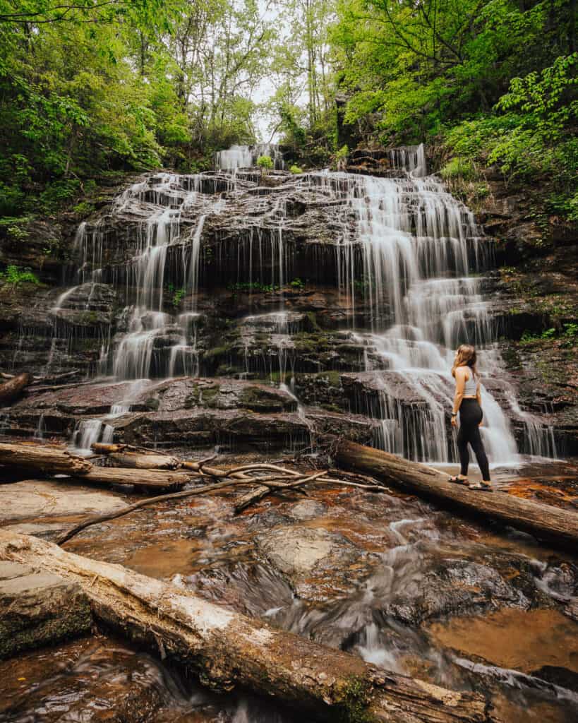
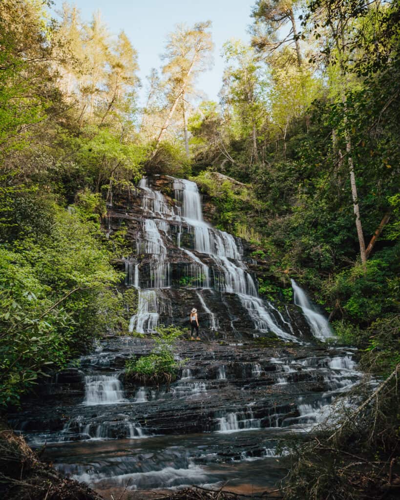
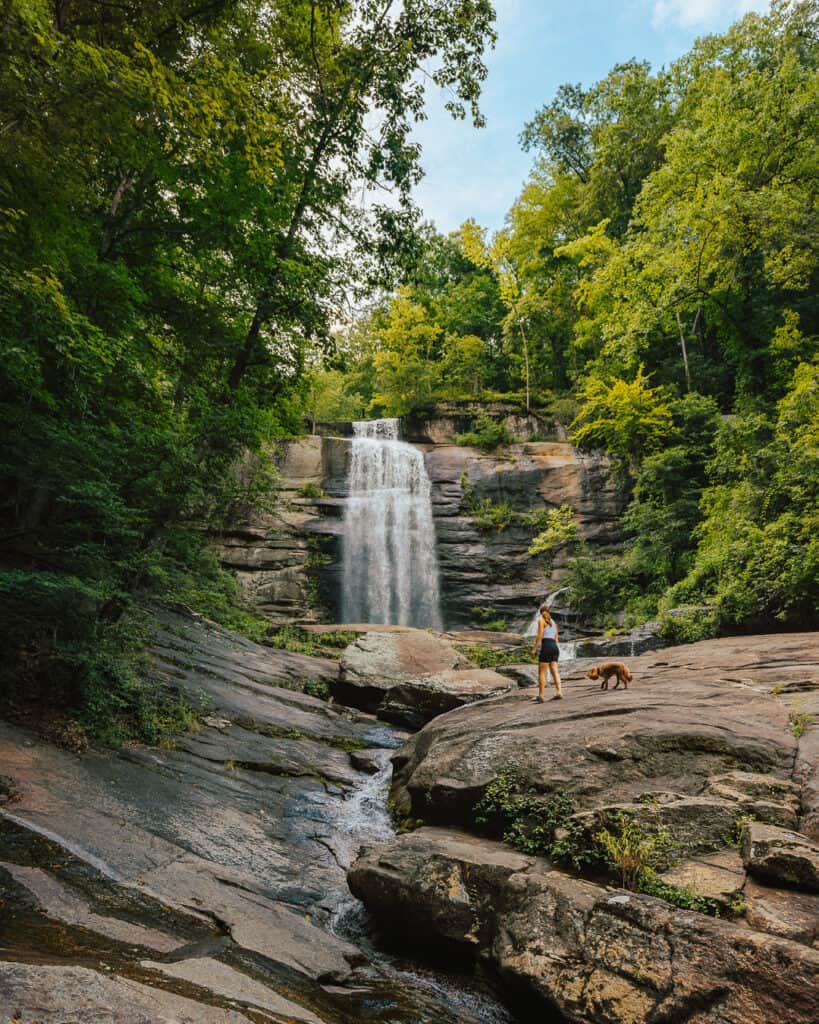
1. Yellow Branch Falls
Distance:
3 miles out & back
Difficulty:
Moderate
Elevation Change:
465 ft.
Pet-Friendly:
Yes
Directions
Fee:
No Fee
Alltrails Map
Yellow Branch Falls is one of my all-time favorite hikes in the Upstate of South Carolina. The trail is a good workout but not too long and the falls at the end are stunning.
The parking lot for this trail isn’t massive, but there’s probably room for 10-20 cars. It’s easy to find as it’s not terribly far from downtown Walhalla.
The trail involves a few minor stream crossings and some natural stairs to get down to the bottom. I love the way the rocks form this waterfall. Definitely one of the most unique waterfalls I’ve seen in the Southeast.
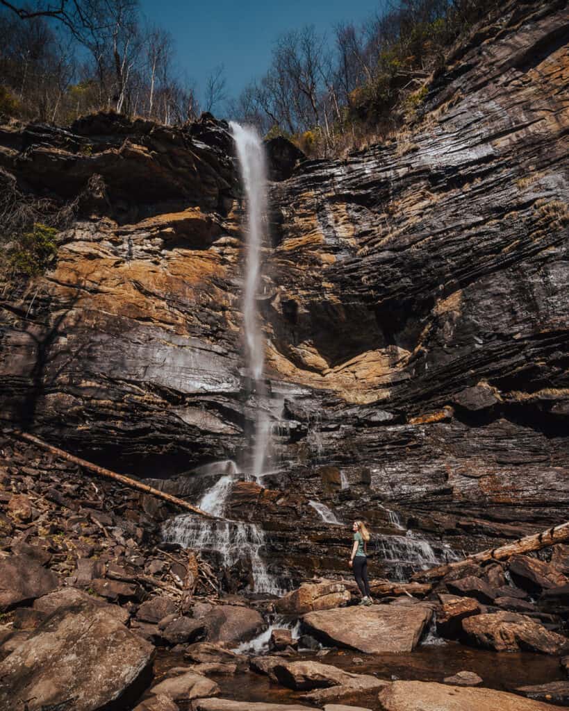
2. Issaqueena Falls
Distance:
0.3 miles out & back
Difficulty:
Easy
Elevation Change:
88 ft.
Pet-Friendly:
Yes
Directions
Fee:
$5 Parking
Alltrails Map
Issaqueena Falls is a great waterfall to add on if you’re also planning on completing Yellow Branch Falls. The two are spitting distance away from each other so it’s easy to complete both in one day.
There is a paved parking lot for this waterfall since it is one of the most popular hikes in the Upstate of South Carolina. Most people come to this area to see this specific waterfall and for good reason.
This waterfall is stunning and so easy to get to. The trail is short and relatively easily traversed.
The last bit to the bottom does require some caution as you go down, but if you are used to hiking it should be no problem for you!
I had a blast sitting at the bottom of this waterfall and just enjoying the view.
3. Station Cove Falls
Distance:
1.6 miles out & back
Difficulty:
Easy
Elevation Change:
98 ft.
Pet-Friendly:
Yes
Directions
Fee:
No Fee
Alltrails Map
Station Cove Falls is also in the Walhalla area but doesn’t get as much attention as the first two waterfalls listed. In terms of bang for your buck, this waterfall is one of the best hikes in the Upstate of South Carolina.
The trail is easy with minimal elevation gain. It’s a great option for kids or dogs that have difficulty dealing with hills or steep inclines.
The walk to get here is through the beautiful, wooded forest. I recommend going on a weekday or early on the weekend since there isn’t a ton of parking for this trailhead.
4. Sids Falls
Distance:
3 miles out & back
Difficulty:
Hard
Elevation Change:
393 ft.
Pet-Friendly:
Yes
Directions
Fee:
No Fee
Alltrails Map
Sids Falls is one of the most unique hikes in the Upstate of South Carolina. This hike is often overlooked by people headed to Brasstown Falls.
If you’re looking to venture off the beaten path, then this is it. Since this hike is more of a ‘hidden gem,’ the parking is sparse and can truly only accommodate a few cars. There isn’t really a parking lot, but more of a dirt spot off the road in front of the gate.
The hike is easy until the last half mile, when you have to push through some overgrowth and then traverse down a steep, muddy trail. I would not attempt this hike if you aren’t comfortable with a little extra adventure and prefer more well-trodden trails.
If you’re willing to give this trail a shot, I can guarantee it’s well worth it. This is one of the coolest waterfalls I’ve seen in South Carolin,a and we did it all by ourselves.
Dogs can do this trail, but be advised that the steep part is not for dogs who are not used to hiking or are not agile. My dog did this trail and didn’t have any issues, but he also goes hiking numerous times a month and is good with voice commands.
I would not attempt to take children on this trail. Additionally, we found numerous ticks after completing this hike since the grass is longer in certain areas.
5. Twin Falls
Distance:
0.7 miles
Difficulty:
Easy
Elevation Change:
Pet-Friendly:
Yes
Directions
Fee:
No Fee
Alltrails Map
I discovered Twin Falls on a road trip up to North Carolina last year, and I’m so glad I did. I was searching for an easy trail break since I’d been in the car for a few hours, and this trail was the perfect remedy for stiff legs.
The parking lot for this trail is small, and it fills up on a perfect summer day, so I’d plan to get there early to complete this hike before the crowds.
For the most part, this trail is easy and straightforward. The area by the falls can be explored, but please use caution and care as the rocks are much more slippery than they appear.
Swimming is not allowed at the falls as it is dangerous. You could swim downstream if you would like, as I saw some small swimming holes along Reedy Cove Creek.
I saw a lot of trash at the trailhead of this hike, so please follow Leave No Trace principles and pick up trash if you see some! Keeping these trails well-maintained is so important for future use, and we all need to do our part.
6. Rainbow Falls
Distance:
4.4 miles
Difficulty:
Moderate
Elevation Change:
1,181 ft.
Pet-Friendly:
Yes
Directions
Day Use Fee:
$6 adults, $3.75 SC seniors (age 65 & older), $3.50 children (6-15); children 5 and under free
Alltrails Map
Rainbow Falls was one of the first trails I did after I moved to South Carolina, and I was so impressed. The trail is located in Jones Gap State Park, only about 45 minutes from Greenville, SC.
The trail is moderate and definitely doable for kids. I enjoyed hiking along the Middle Saluda River for parts of it. There are some sections that are steeper, so be prepared with good shoes and plenty of water, especially if you’re tackling in the summer heat.
The falls at the end of the trail are beautiful, and if you visit during the spring, you will see them in full force.
Jones Gap is pretty popular due to its proximity to Greenville, SC, so keep that in mind when you head this way for a hike. The parking lot can fill up quickly. We arrived at around 9 a.m. on a weekend, and it was almost full.
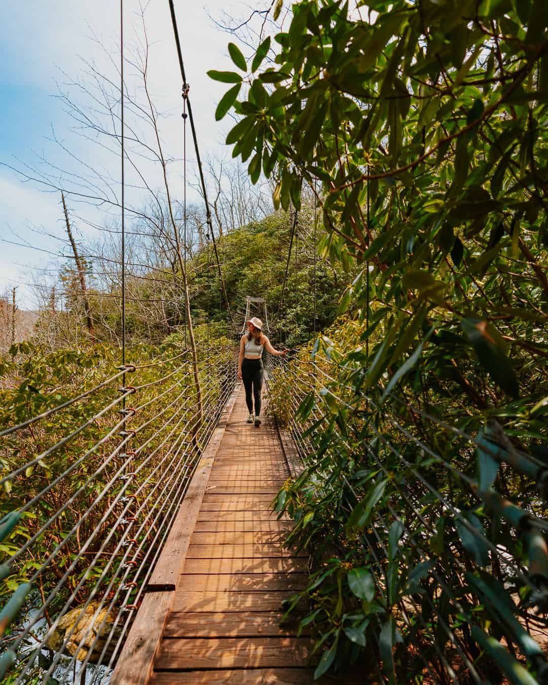
7. Raven Cliff Falls
Distance:
7.6 mile loop
Difficulty:
Hard
Elevation Change:
2,109 ft.
Pet-Friendly:
Yes
Directions
Day Use
Fee:
$3 adults; $1.50 SC seniors (age 65 & older), $1 children (6-15), children 5 and under free
Alltrails Map
I really enjoyed this hike, but I would consider it one of the more challenging hikes I’ve done in the upstate of South Carolina.
The length and elevation change are the two major factors for why this hike is hard, but the trail is also difficult to navigate in certain areas. I recommend having an offline map to make sure you are on the trail when things get a little confusing.
You can just hike to the overlook for the falls, but it’s not nearly as beautiful as the suspension bridge over the actual waterfall.
Be prepared for a lot of ups and downs as you make your way over to the suspension bridge. Additionally, you will also need to tackle a few small ladders. If you’re bringing a dog, you should be comfortable picking them up or directing them down/up these ladders. Otherwise, leave them at home or choose a different trail.
Bring plenty of water on this hike or a way to filter it. There are a few places to fill up, but I would suggest using a 2 or 3-liter water bladder so you don’t run out!
If you want to cut off some distance and time, you can choose to go right at the loop split and do an out-and-back. This will total approximately 5 miles instead of the 7.6 miles for the full loop. You will also avoid the ladders by taking this approach.
One thing to note is that you will not see the overlook. I personally thought the overlook was subpar and would be okay skipping it.
8. Table Rock
Distance:
6.9 miles
Difficulty:
Hard
Elevation Change:
3,316 ft.
Pet-Friendly:
Yes
Directions
Day Use Fee:
$6 adults, $3.75 SC seniors (age 65 & older), $3.50 children (6-15); children 5 and under free
Alltrails Map
Table Rock Trail is probably the most popular trail near Greenville, SC, and one of the most prominent in the upstate of South Carolina.
Located in Table Rock State Park, this strenuous trail has a stunning overlook that is worth the uphill battle. If you get the chance, stay a night or two at the campground. You won’t regret it!
The hike up to Table Rock summit is grueling and shouldn’t be undertaken lightly. It’s basically a 3.5-mile stair stepper.
Additionally, this trail has little to no water, so make sure you pack appropriately. I’d also encourage you to pack a snack or lunch to enjoy at the top. My favorite is homestyle Rice Krispies.
I would not recommend bringing your dog on this hike unless they are incredibly active or conditioned. My dog was exhausted after this trail, and he hikes all the time.
The same goes for children. If your kids are used to hiking, then I would say go for it! Just remember this is a long trail with minimal water, so you should have enough for yourself, your dog, and your kid,s or they should carry some.
Although this trail is tough, the views at the top are well worth it.
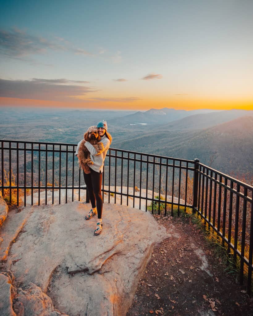
9. Caesar’s Head Overlook
Distance:
0.3 miles
Difficulty:
Easy
Elevation Change:
45 ft.
Pet-Friendly:
Yes
Directions
Day Use Fee:
$3 adults; $1.50 SC seniors (age 65 & older), $1 children (6-15), children 5 and under free
Alltrails Map
Caesar’s Head Overlook is located right near the Caesar’s Head Visitor Center at this state park. If you’re planning on doing the Raven Cliff Falls trail, this is a great one to do afterward to watch the sunset.
The trail is easy and accessible for all ages. Sunset here is absolutely gorgeous and definitely something you shouldn’t miss if you’re in the area.
What is the longest hiking trail in South Carolina?
The longest hike in South Carolina is the
Palmetto Trail
. The trail spans from Walhalla, SC all the way down to the coast, covering over 500 miles.
Does South Carolina have good hiking?
South Carolina has some amazing hikes, specifically in the upstate. You won’t find dramatic mountains here, but there’s a plethora of waterfalls and vistas to explore.
How long is Yellow Branch Falls trail?
Yellow Branch Falls is 3 miles round-trip. I cover this more in the
Yellow Branch Falls
section above.
Conclusion: 9 Must-Do Hikes in the Upstate of South Carolina
Upstate South Carolina has so many great hikes to check out. Whether you only have half a day or want to spend an entire week exploring, there are hikes for everyone.
Take a drive out to Walhalla to see numerous gorgeous waterfalls, spend a day at Caesar’s Head State Park, or take a trip over to Jones Gap State Park to spend some time in nature.
You’re guaranteed to have a great time hiking in upstate South Carolina, regardless of which hikes you choose to do!
Read More:
11 Stunning Hikes Near Cashiers NC
A Complete Guide on Backpacking the Pinnacle Trail North Carolina
Hiking in Hendersonville: 24+ Trails to Check Out
Cate Schweitzer
I’m Cate, fellow explorer and the voice behind the blog! I’m a hiking addict with a love of all things outdoors. Most of what I share on this blog focuses on camping, hiking, backpacking, and other incredible outdoor activities! I currently live in and explore the Southeast, but my husband and I also take numerous "bucket list" trips a year that are focused on major hikes we want to complete. | |||||||||||||||||||||||||||
| Markdown | [Skip to content](https://catescompass.com/hikes-in-the-upstate-of-south-carolina/#main)
[](https://catescompass.com/)
- [Home](https://catescompass.com/)
- [About](https://catescompass.com/about/)
- [Blog](https://catescompass.com/grid/blog/)
- [Destinations](https://catescompass.com/destinations/)
- [North Carolina Travel](https://catescompass.com/north-carolina-travel/)
- [Southeast Travel](https://catescompass.com/southeast-travel/)
- [United States Travel](https://catescompass.com/united-states-travel/)
- [International Travel](https://catescompass.com/international-travel/)
- [My Outdoor Gear](https://app.rockporch.com/Profile/catescompass)
- [Print Shop](https://www.etsy.com/shop/compassprintshop/?etsrc=sdt)
- [Contact](https://catescompass.com/contact-2/)
[](https://catescompass.com/)
# 9 Must Do Hikes in the Upstate of South Carolina
#### Want to go hiking in Upstate South Carolina? I’ve got you covered\!
Hiking in the Upstate of South Carolina is one of my favorite things to do. The area is relatively lesser known than a lot of the other hiking regions in the Southeast, but it still has a ton of incredible hikes to check out.
My all-time favorite area of the upstate is Walhalla, but other incredible areas are Table Rock State Park, Jones Gap State Park, Lake Jocassee, and Caesar’s Head State Park. Below is the list of hikes I think you must do if you visit this area of the state.
Table of Contents
- [1\. Yellow Branch Falls](https://catescompass.com/hikes-in-the-upstate-of-south-carolina/#yellow-branch-falls)
- [2\. Issaqueena Falls](https://catescompass.com/hikes-in-the-upstate-of-south-carolina/#issaqueena-falls)
- [3\. Station Cove Falls](https://catescompass.com/hikes-in-the-upstate-of-south-carolina/#station-cove-falls)
- [4\. Sids Falls](https://catescompass.com/hikes-in-the-upstate-of-south-carolina/#sids-falls)
- [5\. Twin Falls](https://catescompass.com/hikes-in-the-upstate-of-south-carolina/#twin-falls)
- [6\. Rainbow Falls](https://catescompass.com/hikes-in-the-upstate-of-south-carolina/#rainbow-falls)
- [7\. Raven Cliff Falls](https://catescompass.com/hikes-in-the-upstate-of-south-carolina/#raven-cliff-falls)
- [8\. Table Rock](https://catescompass.com/hikes-in-the-upstate-of-south-carolina/#table-rock)
- [9\. Caesar's Head Overlook](https://catescompass.com/hikes-in-the-upstate-of-south-carolina/#caesars-head-overlook)
- [FAQ: Hikes in the Upstate of South Carolina](https://catescompass.com/hikes-in-the-upstate-of-south-carolina/#faq)
- [What is the longest hiking trail in South Carolina?](https://catescompass.com/hikes-in-the-upstate-of-south-carolina/#what-is-the-longest-hiking-trail-in-south-carolina)
- [Does South Carolina have good hiking?](https://catescompass.com/hikes-in-the-upstate-of-south-carolina/#does-south-carolina-have-good-hiking)
- [How long is Yellow Branch Falls trail?](https://catescompass.com/hikes-in-the-upstate-of-south-carolina/#how-long-is-yellow-branch-falls-trail)
- [Conclusion: 9 Must-Do Hikes in the Upstate of South Carolina](https://catescompass.com/hikes-in-the-upstate-of-south-carolina/#conclusion-9-mustdo-hikes-in-the-upstate-of-south-carolina)
- [Read More:](https://catescompass.com/hikes-in-the-upstate-of-south-carolina/#read-more)
# Hiking Items I Can’t Live Without
[This is my go-to hiking pack perfect for any day hike](https://rei.pxf.io/EEYobX)
[The hiking shoes I always reach for](https://rei.pxf.io/2aBxkD) [My favorite headlamp](https://rei.pxf.io/dOq1KQ)
[I swear by this pee cloth for women\!](https://rei.pxf.io/YRkQDO)
[Lightweight water bottle (reusable because we love the planet)](https://rei.pxf.io/K0YnKa)
> [View this post on Instagram](https://www.instagram.com/reel/DFF5z7BRTC2/?utm_source=ig_embed&utm_campaign=loading)
>
> [A post shared by Cate Schweitzer \| Based in the Carolinas 🏕️🐾 (@catescompass)](https://www.instagram.com/reel/DFF5z7BRTC2/?utm_source=ig_embed&utm_campaign=loading)
## 1\. Yellow Branch Falls
- **Distance:** 3 miles out & back
- **Difficulty:** Moderate
- **Elevation Change:** 465 ft.
- **Pet-Friendly:** Yes
- **[Directions](https://www.google.com/maps/place/Yellow+Branch+Falls/@34.7950693,-83.1341676,15z/data=!4m2!3m1!1s0x0:0x5e3de1e1201749b7?sa=X&ved=2ahUKEwjX6If-ipGAAxU_l2oFHVTbCj8Q_BJ6BAhwEAA&ved=2ahUKEwjX6If-ipGAAxU_l2oFHVTbCj8Q_BJ6BAh6EAg)**
- **Fee:** No Fee
- **[Alltrails Map](https://www.alltrails.com/trail/us/south-carolina/yellow-branch-falls-trail?sh=ejzva0)**
Yellow Branch Falls is one of my all-time favorite hikes in the Upstate of South Carolina. The trail is a good workout but not too long and the falls at the end are stunning.
The parking lot for this trail isn’t massive, but there’s probably room for 10-20 cars. It’s easy to find as it’s not terribly far from downtown Walhalla.
The trail involves a few minor stream crossings and some natural stairs to get down to the bottom. I love the way the rocks form this waterfall. Definitely one of the most unique waterfalls I’ve seen in the Southeast.
## 2\. Issaqueena Falls
- **Distance:** 0.3 miles out & back
- **Difficulty:** Easy
- **Elevation Change:** 88 ft.
- **Pet-Friendly:** Yes
- **[Directions](https://www.google.com/maps/place/Issaqueena+Falls,+South+Carolina+29691/data=!4m2!3m1!1s0x8858efa9f429667d:0x27d110d624b295c6?sa=X&ved=2ahUKEwjaxJG8i5GAAxUlk2oFHYI0DpMQ8gF6BAhZEAA&ved=2ahUKEwjaxJG8i5GAAxUlk2oFHYI0DpMQ8gF6BAhpEAE)**
- **Fee:** \$5 Parking
- **[Alltrails Map](https://www.alltrails.com/trail/us/south-carolina/issaqueena-falls-trail?sh=ejzva0)**
Issaqueena Falls is a great waterfall to add on if you’re also planning on completing Yellow Branch Falls. The two are spitting distance away from each other so it’s easy to complete both in one day.
There is a paved parking lot for this waterfall since it is one of the most popular hikes in the Upstate of South Carolina. Most people come to this area to see this specific waterfall and for good reason.
This waterfall is stunning and so easy to get to. The trail is short and relatively easily traversed.
The last bit to the bottom does require some caution as you go down, but if you are used to hiking it should be no problem for you\!
I had a blast sitting at the bottom of this waterfall and just enjoying the view.
## 3\. Station Cove Falls
- **Distance:** 1.6 miles out & back
- **Difficulty:** Easy
- **Elevation Change:** 98 ft.
- **Pet-Friendly:** Yes
- **[Directions](https://www.google.com/maps/place/Station+Cove+Falls+Trailhead/@34.8489318,-83.0770694,17z/data=!3m1!4b1!4m6!3m5!1s0x8858faade161a873:0x7cc7b2d4c38acfcb!8m2!3d34.8489318!4d-83.0744945!16s%2Fg%2F11bxfr45v3?entry=ttu)**
- **Fee:** No Fee
- **[Alltrails Map](https://www.alltrails.com/trail/us/south-carolina/oconee-station-station-cove-falls-trail?sh=ejzva0)**
Station Cove Falls is also in the Walhalla area but doesn’t get as much attention as the first two waterfalls listed. In terms of bang for your buck, this waterfall is one of the best hikes in the Upstate of South Carolina.
The trail is easy with minimal elevation gain. It’s a great option for kids or dogs that have difficulty dealing with hills or steep inclines.
The walk to get here is through the beautiful, wooded forest. I recommend going on a weekday or early on the weekend since there isn’t a ton of parking for this trailhead.
[Check Out My Southeast Map For More\!](https://www.rexby.com/catescompass/unitedstates)
## 4\. Sids Falls
- **Distance:** 3 miles out & back
- **Difficulty:** Hard
- **Elevation Change:** 393 ft.
- **Pet-Friendly:** Yes
- **[Directions](https://www.google.com/maps/place/Sids+Falls+Trail/@34.7419172,-83.3010657,17z/data=!4m15!1m8!3m7!1s0x8858c1aed22d1681:0xa2913fe8f9e47052!2sSids+Falls+Trail!8m2!3d34.7419172!4d-83.298877!10e5!16s%2Fg%2F11j2d7nbvn!3m5!1s0x8858c1aed22d1681:0xa2913fe8f9e47052!8m2!3d34.7419172!4d-83.298877!16s%2Fg%2F11j2d7nbvn?entry=ttu)**
- **Fee:** No Fee
- **[Alltrails Map](https://www.alltrails.com/trail/us/south-carolina/sid-falls?sh=ejzva0)**
Sids Falls is one of the most unique hikes in the Upstate of South Carolina. This hike is often overlooked by people headed to Brasstown Falls.
If you’re looking to venture off the beaten path, then this is it. Since this hike is more of a ‘hidden gem,’ the parking is sparse and can truly only accommodate a few cars. There isn’t really a parking lot, but more of a dirt spot off the road in front of the gate.
The hike is easy until the last half mile, when you have to push through some overgrowth and then traverse down a steep, muddy trail. I would not attempt this hike if you aren’t comfortable with a little extra adventure and prefer more well-trodden trails.
If you’re willing to give this trail a shot, I can guarantee it’s well worth it. This is one of the coolest waterfalls I’ve seen in South Carolin,a and we did it all by ourselves.
Dogs can do this trail, but be advised that the steep part is not for dogs who are not used to hiking or are not agile. My dog did this trail and didn’t have any issues, but he also goes hiking numerous times a month and is good with voice commands.
I would not attempt to take children on this trail. Additionally, we found numerous ticks after completing this hike since the grass is longer in certain areas.
## 5\. Twin Falls
- **Distance:** 0.7 miles
- **Difficulty:** Easy
- **Elevation Change:**
- **Pet-Friendly:** Yes
- **[Directions](https://www.google.com/maps/place/Twin+Falls+Trail/@35.0097608,-82.8239287,17z/data=!3m1!4b1!4m6!3m5!1s0x8859ab55d6e38d61:0x532508adea98e171!8m2!3d35.0097608!4d-82.8213538!16s%2Fg%2F113jvzns2?entry=ttu)**
- **Fee:** No Fee
- **[Alltrails Map](https://www.alltrails.com/trail/us/south-carolina/twin-falls-lower-trail?sh=ejzva0)**
I discovered Twin Falls on a road trip up to North Carolina last year, and I’m so glad I did. I was searching for an easy trail break since I’d been in the car for a few hours, and this trail was the perfect remedy for stiff legs.
The parking lot for this trail is small, and it fills up on a perfect summer day, so I’d plan to get there early to complete this hike before the crowds.
For the most part, this trail is easy and straightforward. The area by the falls can be explored, but please use caution and care as the rocks are much more slippery than they appear.
Swimming is not allowed at the falls as it is dangerous. You could swim downstream if you would like, as I saw some small swimming holes along Reedy Cove Creek.
I saw a lot of trash at the trailhead of this hike, so please follow Leave No Trace principles and pick up trash if you see some! Keeping these trails well-maintained is so important for future use, and we all need to do our part.
## 6\. Rainbow Falls
- **Distance:** 4.4 miles
- **Difficulty:** Moderate
- **Elevation Change:** 1,181 ft.
- **Pet-Friendly:** Yes
- **[Directions](https://www.google.com/maps/place/Parking+lot,+South+Carolina+29661/@35.1319103,-82.5866577,15.09z/data=!4m14!1m7!3m6!1s0x8859b7b96f91c27f:0xff4aaaccb076f1b0!2sRainbow+Falls!8m2!3d35.1335422!4d-82.5880402!16s%2Fg%2F1v1slyyb!3m5!1s0x8859b7d19e591c0b:0xe270f01bb9be3cad!8m2!3d35.1255858!4d-82.5701245!16s%2Fg%2F11cnd8gjjs?entry=ttu)**
- **Day Use Fee:** \$6 adults, \$3.75 SC seniors (age 65 & older), \$3.50 children (6-15); children 5 and under free
- **[Alltrails Map](https://www.alltrails.com/trail/us/south-carolina/rainbow-falls-trail?sh=ejzva0)**
Rainbow Falls was one of the first trails I did after I moved to South Carolina, and I was so impressed. The trail is located in Jones Gap State Park, only about 45 minutes from Greenville, SC.
The trail is moderate and definitely doable for kids. I enjoyed hiking along the Middle Saluda River for parts of it. There are some sections that are steeper, so be prepared with good shoes and plenty of water, especially if you’re tackling in the summer heat.
The falls at the end of the trail are beautiful, and if you visit during the spring, you will see them in full force.
Jones Gap is pretty popular due to its proximity to Greenville, SC, so keep that in mind when you head this way for a hike. The parking lot can fill up quickly. We arrived at around 9 a.m. on a weekend, and it was almost full.
## 7\. Raven Cliff Falls
- **Distance:** 7.6 mile loop
- **Difficulty:** Hard
- **Elevation Change:** 2,109 ft.
- **Pet-Friendly:** Yes
- **[Directions](https://www.google.com/maps/place/Raven+Cliff+Falls+Trailhead/@35.1057802,-82.6619906,14.9z/data=!4m14!1m7!3m6!1s0x8859b1b40fe2d0d1:0x4a3d196ca6cc1599!2sRaven+Cliff+Falls+Suspension+Bridge!8m2!3d35.1048528!4d-82.6611613!16s%2Fg%2F11n0z_g7mb!3m5!1s0x8859b6d0911187b3:0xf9eb6aeadaf601e8!8m2!3d35.1156065!4d-82.6383153!16s%2Fg%2F11c3svkxdf?entry=ttu)**
- **Day Use** **Fee:** \$3 adults; \$1.50 SC seniors (age 65 & older), \$1 children (6-15), children 5 and under free
- **[Alltrails Map](https://www.alltrails.com/trail/us/south-carolina/raven-cliff-falls-loop-trail?sh=ejzva0)**
I really enjoyed this hike, but I would consider it one of the more challenging hikes I’ve done in the upstate of South Carolina.
The length and elevation change are the two major factors for why this hike is hard, but the trail is also difficult to navigate in certain areas. I recommend having an offline map to make sure you are on the trail when things get a little confusing.
You can just hike to the overlook for the falls, but it’s not nearly as beautiful as the suspension bridge over the actual waterfall.
Be prepared for a lot of ups and downs as you make your way over to the suspension bridge. Additionally, you will also need to tackle a few small ladders. If you’re bringing a dog, you should be comfortable picking them up or directing them down/up these ladders. Otherwise, leave them at home or choose a different trail.
Bring plenty of water on this hike or a way to filter it. There are a few places to fill up, but I would suggest using a 2 or 3-liter water bladder so you don’t run out\!
If you want to cut off some distance and time, you can choose to go right at the loop split and do an out-and-back. This will total approximately 5 miles instead of the 7.6 miles for the full loop. You will also avoid the ladders by taking this approach.
One thing to note is that you will not see the overlook. I personally thought the overlook was subpar and would be okay skipping it.
## 8\. Table Rock
- **Distance:** 6.9 miles
- **Difficulty:** Hard
- **Elevation Change:** 3,316 ft.
- **Pet-Friendly:** Yes
- **[Directions](https://www.google.com/maps/place/Table+Rock+Summit+Trailhead/@35.0320309,-82.7027874,16.09z/data=!4m6!3m5!1s0x8859b2fa4f7d31f3:0x7dbeba162bbab940!8m2!3d35.0319923!4d-82.7003067!16s%2Fg%2F11dfpk4n34?entry=ttu)**
- **Day Use Fee:** \$6 adults, \$3.75 SC seniors (age 65 & older), \$3.50 children (6-15); children 5 and under free
- **[Alltrails Map](https://www.alltrails.com/trail/us/south-carolina/table-rock-trail?sh=ejzva0)**
Table Rock Trail is probably the most popular trail near Greenville, SC, and one of the most prominent in the upstate of South Carolina.
Located in Table Rock State Park, this strenuous trail has a stunning overlook that is worth the uphill battle. If you get the chance, stay a night or two at the campground. You won’t regret it\!
The hike up to Table Rock summit is grueling and shouldn’t be undertaken lightly. It’s basically a 3.5-mile stair stepper.
Additionally, this trail has little to no water, so make sure you pack appropriately. I’d also encourage you to pack a snack or lunch to enjoy at the top. My favorite is homestyle Rice Krispies.
I would not recommend bringing your dog on this hike unless they are incredibly active or conditioned. My dog was exhausted after this trail, and he hikes all the time.
The same goes for children. If your kids are used to hiking, then I would say go for it! Just remember this is a long trail with minimal water, so you should have enough for yourself, your dog, and your kid,s or they should carry some.
Although this trail is tough, the views at the top are well worth it.
## 9\. Caesar’s Head Overlook
- **Distance:** 0.3 miles
- **Difficulty:** Easy
- **Elevation Change:** 45 ft.
- **Pet-Friendly:** Yes
- **[Directions](https://www.google.com/maps/place/Caesar's+Head+Overlook/@35.1064176,-82.635374,15.54z/data=!4m6!3m5!1s0x8859b6c1f2f3fd1b:0x3f63aef7a0be1328!8m2!3d35.1055876!4d-82.6283247!16s%2Fg%2F11crzxgr78?entry=ttu)**
- **Day Use Fee:** \$3 adults; \$1.50 SC seniors (age 65 & older), \$1 children (6-15), children 5 and under free
- **[Alltrails Map](https://www.alltrails.com/trail/us/south-carolina/caesars-head-overlook-trail?sh=ejzva0)**
Caesar’s Head Overlook is located right near the Caesar’s Head Visitor Center at this state park. If you’re planning on doing the Raven Cliff Falls trail, this is a great one to do afterward to watch the sunset.
The trail is easy and accessible for all ages. Sunset here is absolutely gorgeous and definitely something you shouldn’t miss if you’re in the area.
## FAQ: Hikes in the Upstate of South Carolina
### What is the longest hiking trail in South Carolina?
The longest hike in South Carolina is the [Palmetto Trail](https://www.sctrails.net/resources/palmetto-trail#:~:text=Established%201994%2C%20the%20Palmetto%20Trail,from%201.3%20to%2047%20miles.). The trail spans from Walhalla, SC all the way down to the coast, covering over 500 miles.
### Does South Carolina have good hiking?
South Carolina has some amazing hikes, specifically in the upstate. You won’t find dramatic mountains here, but there’s a plethora of waterfalls and vistas to explore.
### How long is Yellow Branch Falls trail?
Yellow Branch Falls is 3 miles round-trip. I cover this more in the [Yellow Branch Falls](https://catescompass.com/hikes-in-the-upstate-of-south-carolina/#yellow-branch-falls) section above.
## Conclusion: 9 Must-Do Hikes in the Upstate of South Carolina
Upstate South Carolina has so many great hikes to check out. Whether you only have half a day or want to spend an entire week exploring, there are hikes for everyone.
Take a drive out to Walhalla to see numerous gorgeous waterfalls, spend a day at Caesar’s Head State Park, or take a trip over to Jones Gap State Park to spend some time in nature.
You’re guaranteed to have a great time hiking in upstate South Carolina, regardless of which hikes you choose to do\!
## Read More:
[**11 Stunning Hikes Near Cashiers NC**](https://catescompass.com/hikes-near-cashiers-nc/)
[**A Complete Guide on Backpacking the Pinnacle Trail North Carolina**](https://catescompass.com/pinnacle-trail-north-carolina/)
[**Hiking in Hendersonville: 24+ Trails to Check Out**](https://catescompass.com/hiking-in-hendersonville/)

**[Cate Schweitzer](https://catescompass.com/author/weese003/ "Posts by Cate Schweitzer")**
I’m Cate, fellow explorer and the voice behind the blog! I’m a hiking addict with a love of all things outdoors. Most of what I share on this blog focuses on camping, hiking, backpacking, and other incredible outdoor activities! I currently live in and explore the Southeast, but my husband and I also take numerous "bucket list" trips a year that are focused on major hikes we want to complete.
## About Me

Hi! I'm Cate, a Wisconsin native turned Southeast Photographer who loves to capture the outdoors on my Sony a7rv. I'm a hiking and camping aficionado with a passion for travel and trying new things\!
- [Instagram](https://www.instagram.com/catescompass/)
- [Pinterest](https://www.pinterest.com/catescompass/)
- [Facebook](https://www.facebook.com/Cates-Compass-107732718749377)
© 2026 Cate's Compass
[Portfolio](https://catescompass.com/photo-portfolio/)
[Contact Me](https://catescompass.com/contact-2/)
[Privacy Policy](https://catescompass.com/privacy-policy/)
Review My Order
0
Subtotal
Taxes & shipping calculated at checkout
[Checkout](https://catescompass.com/checkout/)
0
- [Home](https://catescompass.com/)
- [About](https://catescompass.com/about/)
- [Blog](https://catescompass.com/grid/blog/)
- [Destinations](https://catescompass.com/destinations/)
Toggle child menu
- [North Carolina Travel](https://catescompass.com/north-carolina-travel/)
- [Southeast Travel](https://catescompass.com/southeast-travel/)
- [United States Travel](https://catescompass.com/united-states-travel/)
- [International Travel](https://catescompass.com/international-travel/)
- [My Outdoor Gear](https://app.rockporch.com/Profile/catescompass)
- [Print Shop](https://www.etsy.com/shop/compassprintshop/?etsrc=sdt)
- [Contact](https://catescompass.com/contact-2/)
Notifications | |||||||||||||||||||||||||||
| Readable Markdown | #### Want to go hiking in Upstate South Carolina? I’ve got you covered\!
Hiking in the Upstate of South Carolina is one of my favorite things to do. The area is relatively lesser known than a lot of the other hiking regions in the Southeast, but it still has a ton of incredible hikes to check out.
My all-time favorite area of the upstate is Walhalla, but other incredible areas are Table Rock State Park, Jones Gap State Park, Lake Jocassee, and Caesar’s Head State Park. Below is the list of hikes I think you must do if you visit this area of the state.
## 1\. Yellow Branch Falls

- **Distance:** 3 miles out & back
- **Difficulty:** Moderate
- **Elevation Change:** 465 ft.
- **Pet-Friendly:** Yes
- **[Directions](https://www.google.com/maps/place/Yellow+Branch+Falls/@34.7950693,-83.1341676,15z/data=!4m2!3m1!1s0x0:0x5e3de1e1201749b7?sa=X&ved=2ahUKEwjX6If-ipGAAxU_l2oFHVTbCj8Q_BJ6BAhwEAA&ved=2ahUKEwjX6If-ipGAAxU_l2oFHVTbCj8Q_BJ6BAh6EAg)**
- **Fee:** No Fee
- **[Alltrails Map](https://www.alltrails.com/trail/us/south-carolina/yellow-branch-falls-trail?sh=ejzva0)**
Yellow Branch Falls is one of my all-time favorite hikes in the Upstate of South Carolina. The trail is a good workout but not too long and the falls at the end are stunning.
The parking lot for this trail isn’t massive, but there’s probably room for 10-20 cars. It’s easy to find as it’s not terribly far from downtown Walhalla.
The trail involves a few minor stream crossings and some natural stairs to get down to the bottom. I love the way the rocks form this waterfall. Definitely one of the most unique waterfalls I’ve seen in the Southeast.
## 2\. Issaqueena Falls

- **Distance:** 0.3 miles out & back
- **Difficulty:** Easy
- **Elevation Change:** 88 ft.
- **Pet-Friendly:** Yes
- **[Directions](https://www.google.com/maps/place/Issaqueena+Falls,+South+Carolina+29691/data=!4m2!3m1!1s0x8858efa9f429667d:0x27d110d624b295c6?sa=X&ved=2ahUKEwjaxJG8i5GAAxUlk2oFHYI0DpMQ8gF6BAhZEAA&ved=2ahUKEwjaxJG8i5GAAxUlk2oFHYI0DpMQ8gF6BAhpEAE)**
- **Fee:** \$5 Parking
- **[Alltrails Map](https://www.alltrails.com/trail/us/south-carolina/issaqueena-falls-trail?sh=ejzva0)**
Issaqueena Falls is a great waterfall to add on if you’re also planning on completing Yellow Branch Falls. The two are spitting distance away from each other so it’s easy to complete both in one day.
There is a paved parking lot for this waterfall since it is one of the most popular hikes in the Upstate of South Carolina. Most people come to this area to see this specific waterfall and for good reason.
This waterfall is stunning and so easy to get to. The trail is short and relatively easily traversed.
The last bit to the bottom does require some caution as you go down, but if you are used to hiking it should be no problem for you\!
I had a blast sitting at the bottom of this waterfall and just enjoying the view.
## 3\. Station Cove Falls

- **Distance:** 1.6 miles out & back
- **Difficulty:** Easy
- **Elevation Change:** 98 ft.
- **Pet-Friendly:** Yes
- **[Directions](https://www.google.com/maps/place/Station+Cove+Falls+Trailhead/@34.8489318,-83.0770694,17z/data=!3m1!4b1!4m6!3m5!1s0x8858faade161a873:0x7cc7b2d4c38acfcb!8m2!3d34.8489318!4d-83.0744945!16s%2Fg%2F11bxfr45v3?entry=ttu)**
- **Fee:** No Fee
- **[Alltrails Map](https://www.alltrails.com/trail/us/south-carolina/oconee-station-station-cove-falls-trail?sh=ejzva0)**
Station Cove Falls is also in the Walhalla area but doesn’t get as much attention as the first two waterfalls listed. In terms of bang for your buck, this waterfall is one of the best hikes in the Upstate of South Carolina.
The trail is easy with minimal elevation gain. It’s a great option for kids or dogs that have difficulty dealing with hills or steep inclines.
The walk to get here is through the beautiful, wooded forest. I recommend going on a weekday or early on the weekend since there isn’t a ton of parking for this trailhead.
## 4\. Sids Falls

- **Distance:** 3 miles out & back
- **Difficulty:** Hard
- **Elevation Change:** 393 ft.
- **Pet-Friendly:** Yes
- **[Directions](https://www.google.com/maps/place/Sids+Falls+Trail/@34.7419172,-83.3010657,17z/data=!4m15!1m8!3m7!1s0x8858c1aed22d1681:0xa2913fe8f9e47052!2sSids+Falls+Trail!8m2!3d34.7419172!4d-83.298877!10e5!16s%2Fg%2F11j2d7nbvn!3m5!1s0x8858c1aed22d1681:0xa2913fe8f9e47052!8m2!3d34.7419172!4d-83.298877!16s%2Fg%2F11j2d7nbvn?entry=ttu)**
- **Fee:** No Fee
- **[Alltrails Map](https://www.alltrails.com/trail/us/south-carolina/sid-falls?sh=ejzva0)**
Sids Falls is one of the most unique hikes in the Upstate of South Carolina. This hike is often overlooked by people headed to Brasstown Falls.
If you’re looking to venture off the beaten path, then this is it. Since this hike is more of a ‘hidden gem,’ the parking is sparse and can truly only accommodate a few cars. There isn’t really a parking lot, but more of a dirt spot off the road in front of the gate.
The hike is easy until the last half mile, when you have to push through some overgrowth and then traverse down a steep, muddy trail. I would not attempt this hike if you aren’t comfortable with a little extra adventure and prefer more well-trodden trails.
If you’re willing to give this trail a shot, I can guarantee it’s well worth it. This is one of the coolest waterfalls I’ve seen in South Carolin,a and we did it all by ourselves.
Dogs can do this trail, but be advised that the steep part is not for dogs who are not used to hiking or are not agile. My dog did this trail and didn’t have any issues, but he also goes hiking numerous times a month and is good with voice commands.
I would not attempt to take children on this trail. Additionally, we found numerous ticks after completing this hike since the grass is longer in certain areas.
## 5\. Twin Falls

- **Distance:** 0.7 miles
- **Difficulty:** Easy
- **Elevation Change:**
- **Pet-Friendly:** Yes
- **[Directions](https://www.google.com/maps/place/Twin+Falls+Trail/@35.0097608,-82.8239287,17z/data=!3m1!4b1!4m6!3m5!1s0x8859ab55d6e38d61:0x532508adea98e171!8m2!3d35.0097608!4d-82.8213538!16s%2Fg%2F113jvzns2?entry=ttu)**
- **Fee:** No Fee
- **[Alltrails Map](https://www.alltrails.com/trail/us/south-carolina/twin-falls-lower-trail?sh=ejzva0)**
I discovered Twin Falls on a road trip up to North Carolina last year, and I’m so glad I did. I was searching for an easy trail break since I’d been in the car for a few hours, and this trail was the perfect remedy for stiff legs.
The parking lot for this trail is small, and it fills up on a perfect summer day, so I’d plan to get there early to complete this hike before the crowds.
For the most part, this trail is easy and straightforward. The area by the falls can be explored, but please use caution and care as the rocks are much more slippery than they appear.
Swimming is not allowed at the falls as it is dangerous. You could swim downstream if you would like, as I saw some small swimming holes along Reedy Cove Creek.
I saw a lot of trash at the trailhead of this hike, so please follow Leave No Trace principles and pick up trash if you see some! Keeping these trails well-maintained is so important for future use, and we all need to do our part.
## 6\. Rainbow Falls

- **Distance:** 4.4 miles
- **Difficulty:** Moderate
- **Elevation Change:** 1,181 ft.
- **Pet-Friendly:** Yes
- **[Directions](https://www.google.com/maps/place/Parking+lot,+South+Carolina+29661/@35.1319103,-82.5866577,15.09z/data=!4m14!1m7!3m6!1s0x8859b7b96f91c27f:0xff4aaaccb076f1b0!2sRainbow+Falls!8m2!3d35.1335422!4d-82.5880402!16s%2Fg%2F1v1slyyb!3m5!1s0x8859b7d19e591c0b:0xe270f01bb9be3cad!8m2!3d35.1255858!4d-82.5701245!16s%2Fg%2F11cnd8gjjs?entry=ttu)**
- **Day Use Fee:** \$6 adults, \$3.75 SC seniors (age 65 & older), \$3.50 children (6-15); children 5 and under free
- **[Alltrails Map](https://www.alltrails.com/trail/us/south-carolina/rainbow-falls-trail?sh=ejzva0)**
Rainbow Falls was one of the first trails I did after I moved to South Carolina, and I was so impressed. The trail is located in Jones Gap State Park, only about 45 minutes from Greenville, SC.
The trail is moderate and definitely doable for kids. I enjoyed hiking along the Middle Saluda River for parts of it. There are some sections that are steeper, so be prepared with good shoes and plenty of water, especially if you’re tackling in the summer heat.
The falls at the end of the trail are beautiful, and if you visit during the spring, you will see them in full force.
Jones Gap is pretty popular due to its proximity to Greenville, SC, so keep that in mind when you head this way for a hike. The parking lot can fill up quickly. We arrived at around 9 a.m. on a weekend, and it was almost full.
## 7\. Raven Cliff Falls

- **Distance:** 7.6 mile loop
- **Difficulty:** Hard
- **Elevation Change:** 2,109 ft.
- **Pet-Friendly:** Yes
- **[Directions](https://www.google.com/maps/place/Raven+Cliff+Falls+Trailhead/@35.1057802,-82.6619906,14.9z/data=!4m14!1m7!3m6!1s0x8859b1b40fe2d0d1:0x4a3d196ca6cc1599!2sRaven+Cliff+Falls+Suspension+Bridge!8m2!3d35.1048528!4d-82.6611613!16s%2Fg%2F11n0z_g7mb!3m5!1s0x8859b6d0911187b3:0xf9eb6aeadaf601e8!8m2!3d35.1156065!4d-82.6383153!16s%2Fg%2F11c3svkxdf?entry=ttu)**
- **Day Use** **Fee:** \$3 adults; \$1.50 SC seniors (age 65 & older), \$1 children (6-15), children 5 and under free
- **[Alltrails Map](https://www.alltrails.com/trail/us/south-carolina/raven-cliff-falls-loop-trail?sh=ejzva0)**
I really enjoyed this hike, but I would consider it one of the more challenging hikes I’ve done in the upstate of South Carolina.
The length and elevation change are the two major factors for why this hike is hard, but the trail is also difficult to navigate in certain areas. I recommend having an offline map to make sure you are on the trail when things get a little confusing.
You can just hike to the overlook for the falls, but it’s not nearly as beautiful as the suspension bridge over the actual waterfall.
Be prepared for a lot of ups and downs as you make your way over to the suspension bridge. Additionally, you will also need to tackle a few small ladders. If you’re bringing a dog, you should be comfortable picking them up or directing them down/up these ladders. Otherwise, leave them at home or choose a different trail.
Bring plenty of water on this hike or a way to filter it. There are a few places to fill up, but I would suggest using a 2 or 3-liter water bladder so you don’t run out\!
If you want to cut off some distance and time, you can choose to go right at the loop split and do an out-and-back. This will total approximately 5 miles instead of the 7.6 miles for the full loop. You will also avoid the ladders by taking this approach.
One thing to note is that you will not see the overlook. I personally thought the overlook was subpar and would be okay skipping it.
## 8\. Table Rock
- **Distance:** 6.9 miles
- **Difficulty:** Hard
- **Elevation Change:** 3,316 ft.
- **Pet-Friendly:** Yes
- **[Directions](https://www.google.com/maps/place/Table+Rock+Summit+Trailhead/@35.0320309,-82.7027874,16.09z/data=!4m6!3m5!1s0x8859b2fa4f7d31f3:0x7dbeba162bbab940!8m2!3d35.0319923!4d-82.7003067!16s%2Fg%2F11dfpk4n34?entry=ttu)**
- **Day Use Fee:** \$6 adults, \$3.75 SC seniors (age 65 & older), \$3.50 children (6-15); children 5 and under free
- **[Alltrails Map](https://www.alltrails.com/trail/us/south-carolina/table-rock-trail?sh=ejzva0)**
Table Rock Trail is probably the most popular trail near Greenville, SC, and one of the most prominent in the upstate of South Carolina.
Located in Table Rock State Park, this strenuous trail has a stunning overlook that is worth the uphill battle. If you get the chance, stay a night or two at the campground. You won’t regret it\!
The hike up to Table Rock summit is grueling and shouldn’t be undertaken lightly. It’s basically a 3.5-mile stair stepper.
Additionally, this trail has little to no water, so make sure you pack appropriately. I’d also encourage you to pack a snack or lunch to enjoy at the top. My favorite is homestyle Rice Krispies.
I would not recommend bringing your dog on this hike unless they are incredibly active or conditioned. My dog was exhausted after this trail, and he hikes all the time.
The same goes for children. If your kids are used to hiking, then I would say go for it! Just remember this is a long trail with minimal water, so you should have enough for yourself, your dog, and your kid,s or they should carry some.
Although this trail is tough, the views at the top are well worth it.
## 9\. Caesar’s Head Overlook

- **Distance:** 0.3 miles
- **Difficulty:** Easy
- **Elevation Change:** 45 ft.
- **Pet-Friendly:** Yes
- **[Directions](https://www.google.com/maps/place/Caesar's+Head+Overlook/@35.1064176,-82.635374,15.54z/data=!4m6!3m5!1s0x8859b6c1f2f3fd1b:0x3f63aef7a0be1328!8m2!3d35.1055876!4d-82.6283247!16s%2Fg%2F11crzxgr78?entry=ttu)**
- **Day Use Fee:** \$3 adults; \$1.50 SC seniors (age 65 & older), \$1 children (6-15), children 5 and under free
- **[Alltrails Map](https://www.alltrails.com/trail/us/south-carolina/caesars-head-overlook-trail?sh=ejzva0)**
Caesar’s Head Overlook is located right near the Caesar’s Head Visitor Center at this state park. If you’re planning on doing the Raven Cliff Falls trail, this is a great one to do afterward to watch the sunset.
The trail is easy and accessible for all ages. Sunset here is absolutely gorgeous and definitely something you shouldn’t miss if you’re in the area.
### What is the longest hiking trail in South Carolina?
The longest hike in South Carolina is the [Palmetto Trail](https://www.sctrails.net/resources/palmetto-trail#:~:text=Established%201994%2C%20the%20Palmetto%20Trail,from%201.3%20to%2047%20miles.). The trail spans from Walhalla, SC all the way down to the coast, covering over 500 miles.
### Does South Carolina have good hiking?
South Carolina has some amazing hikes, specifically in the upstate. You won’t find dramatic mountains here, but there’s a plethora of waterfalls and vistas to explore.
### How long is Yellow Branch Falls trail?
Yellow Branch Falls is 3 miles round-trip. I cover this more in the [Yellow Branch Falls](https://catescompass.com/hikes-in-the-upstate-of-south-carolina/#yellow-branch-falls) section above.
## Conclusion: 9 Must-Do Hikes in the Upstate of South Carolina
Upstate South Carolina has so many great hikes to check out. Whether you only have half a day or want to spend an entire week exploring, there are hikes for everyone.
Take a drive out to Walhalla to see numerous gorgeous waterfalls, spend a day at Caesar’s Head State Park, or take a trip over to Jones Gap State Park to spend some time in nature.
You’re guaranteed to have a great time hiking in upstate South Carolina, regardless of which hikes you choose to do\!
## Read More:
[**11 Stunning Hikes Near Cashiers NC**](https://catescompass.com/hikes-near-cashiers-nc/)
[**A Complete Guide on Backpacking the Pinnacle Trail North Carolina**](https://catescompass.com/pinnacle-trail-north-carolina/)
[**Hiking in Hendersonville: 24+ Trails to Check Out**](https://catescompass.com/hiking-in-hendersonville/)

**[Cate Schweitzer](https://catescompass.com/author/weese003/ "Posts by Cate Schweitzer")**
I’m Cate, fellow explorer and the voice behind the blog! I’m a hiking addict with a love of all things outdoors. Most of what I share on this blog focuses on camping, hiking, backpacking, and other incredible outdoor activities! I currently live in and explore the Southeast, but my husband and I also take numerous "bucket list" trips a year that are focused on major hikes we want to complete. | |||||||||||||||||||||||||||
| ML Classification | ||||||||||||||||||||||||||||
| ML Categories |
Raw JSON{
"/Hobbies_and_Leisure": 770,
"/Hobbies_and_Leisure/Outdoors": 770,
"/Hobbies_and_Leisure/Outdoors/Hiking_and_Camping": 768,
"/Travel_and_Transportation": 295,
"/Travel_and_Transportation/Specialty_Travel": 198,
"/Travel_and_Transportation/Specialty_Travel/Adventure_Travel": 190,
"/Sports": 153,
"/Sports/Individual_Sports": 147,
"/Sports/Individual_Sports/Running_and_Walking": 133
} | |||||||||||||||||||||||||||
| ML Page Types |
Raw JSON{
"/Article": 896,
"/Article/Roundup": 651
} | |||||||||||||||||||||||||||
| ML Intent Types |
Raw JSON{
"Informational": 999
} | |||||||||||||||||||||||||||
| Content Metadata | ||||||||||||||||||||||||||||
| Language | en-us | |||||||||||||||||||||||||||
| Author | Cate Schweitzer | |||||||||||||||||||||||||||
| Publish Time | 2023-07-17 07:52:33 (2 years ago) | |||||||||||||||||||||||||||
| Original Publish Time | 2023-07-17 07:52:33 (2 years ago) | |||||||||||||||||||||||||||
| Republished | No | |||||||||||||||||||||||||||
| Word Count (Total) | 2,404 | |||||||||||||||||||||||||||
| Word Count (Content) | 2,102 | |||||||||||||||||||||||||||
| Links | ||||||||||||||||||||||||||||
| External Links | 39 | |||||||||||||||||||||||||||
| Internal Links | 25 | |||||||||||||||||||||||||||
| Technical SEO | ||||||||||||||||||||||||||||
| Meta Nofollow | No | |||||||||||||||||||||||||||
| Meta Noarchive | No | |||||||||||||||||||||||||||
| JS Rendered | No | |||||||||||||||||||||||||||
| Redirect Target | null | |||||||||||||||||||||||||||
| Performance | ||||||||||||||||||||||||||||
| Download Time (ms) | 3,106 | |||||||||||||||||||||||||||
| TTFB (ms) | 2,973 | |||||||||||||||||||||||||||
| Download Size (bytes) | 60,118 | |||||||||||||||||||||||||||
| Shard | 113 (laksa) | |||||||||||||||||||||||||||
| Root Hash | 5410693683336525913 | |||||||||||||||||||||||||||
| Unparsed URL | com,catescompass!/hikes-in-the-upstate-of-south-carolina/ s443 | |||||||||||||||||||||||||||