ℹ️ Skipped - page is already crawled
| Filter | Status | Condition | Details |
|---|---|---|---|
| HTTP status | PASS | download_http_code = 200 | HTTP 200 |
| Age cutoff | PASS | download_stamp > now() - 6 MONTH | 0.1 months ago |
| History drop | PASS | isNull(history_drop_reason) | No drop reason |
| Spam/ban | PASS | fh_dont_index != 1 AND ml_spam_score = 0 | ml_spam_score=0 |
| Canonical | PASS | meta_canonical IS NULL OR = '' OR = src_unparsed | Not set |
| Property | Value |
|---|---|
| URL | https://cassiescompass.com/fresno-hikes/ |
| Last Crawled | 2026-04-19 16:51:39 (2 days ago) |
| First Indexed | 2024-03-29 12:14:57 (2 years ago) |
| HTTP Status Code | 200 |
| Meta Title | 13 Stunning Hikes Near Fresno CA – Cassie's Compass |
| Meta Description | null |
| Meta Canonical | null |
| Boilerpipe Text | Cassie’s Compass contains affiliate links and is also an Amazon Services LLC Associates Program member. If you make a purchase using one of these links, I may receive compensation at no extra cost to you. See my
Privacy Policy
for more information.
Are you looking for the best Fresno hikes? I’ve got you covered.
Fresno may not come to mind as a hiking mecca as we are located in the flat Central Valley of California. However, our proximity to the Sierra Nevadas puts a ton of great hiking at our fingertips.
As a Fresno resident
, hiking is one of my favorite weekend activities.
While we all know that there are some stunning hikes in the
four nearby National Parks
, sometimes we don’t want to go all the way to a National Park to get some hiking in.
Many of the hikes I’ve listed hikes are less than an hour drive from downtown! If you are looking for some
new outdoor places to explore that are nearby
, then read on.
Here are 13 of my favorite hikes near Fresno, plus the best walking trails in Fresno.
(
ps. If you want even more hikes beyond Fresno, check out my
Fresno day trips map
featuring over 200 pins
.)
#1 resource
Fresno Places & Hidden Gems Map
Discover the hidden gems of Fresno with my
hand-picked collection of over 200 must-see spots
. I’ve compiled my years exploring
Fresno and its surrounding day trips
all in one place with an easy-to-use legend sorted by activity and proximity.
Download the map and get ready to discover the magic of Fresno, one pin at a time!
1. Pincushion
35 minutes from Fresno | Moderate
The view from Pincushion
Are you from Fresno if you haven’t hiked Pincushion? Nestled amidst rolling hills and oak trees, this trail offers a perfect blend of challenge and beauty. As you trek along the well-maintained paths, you’ll be treated to breathtaking views of Millerton Lake sparkling in the sunlight and the rugged terrain of the Sierra Nevada foothills.
AllTrails Map
2.8-mile loop
900-foot elevation gain
2-hour hike
Minimal shade
No Dogs
Park at Pincushion Peak Trailhead pullout on Sky Harbour Road
2. Lewis Creek Trail (Corlieu Falls)
1 hour from Fresno | Moderate
Corlieu Falls at low volume
You will see the pullout for the Lewis Creek Trail
on your way to Yosemite
. The nice thing about this trail is the parking and trailhead are easy to find. It can be steep getting back up to the parking lot, especially if it is muddy. See Corlieu and Red Rock Falls.
AllTrails Map
3.8 miles out and back
500-foot elevation gain
1.5 hour hike
Lots of shade
Mud and river crossing
Dog friendly
Park at Lewis Creek Trailhead parking lot off Highway 41
3. Big Table Mountain via Wellbarn Road
40 minutes from Fresno | Moderate-Difficult
Photo Credit: Diem N via AllTrails
Big Table Mountain is near Millerton and Pincushion. Follow a somewhat steep cow trail, but the hike flattens out at the top of the plateau, leading to great views of Millerton and the surrounding foothills.
AllTrails Map
7.9 miles out and back
1700-foot elevation gain
4.5 hour hike
Minimal shade
Dog friendly
Park on Wellbarn Road
4. Willow Creek (Angel Falls)
1 hour from Fresno | Moderate
Photo Credit: Kaitlyn Sanson via AllTrails
Angel Falls is near Bass Lake. Cross a bridge that leads to the trail that will take you to Devil’s Slide and Angel Falls. You’ll be right next to the restaurants and shops at Bass if you want a snack or meal after your hike.
AllTrails Map
3-mile loop
600-foot elevation gain
2-hour hike
Decent shade
Dog friendly
Paid parking in a turnout off Road 274
5. Pa’San Ridge
50 minutes from Fresno | Easy-Moderate
Photo Credit: Gavyn Tapp via AllTrails
The Pa’San Ridge Trail is north of Millerton Lake. It is best known for the San Joaquin River footbridge that you will cross towards the beginning of the hike. It is also a nice walk to the bridge and back before the loop begins if you want a shorter hike.
AllTrails Map
7.6-mile loop
1200-foot elevation gain
4 hour hike
Minimal shade
Dog friendly
Paid parking on Smalley Road
6. Stevenson Falls
1 hour from Fresno | Easy
Stevenson Falls in spring
Stevenson Falls is a paved fire road that leads to a waterfall right on the road. Because it is paved, it is a good hike for families and is one of the easiest waterfalls to get to near Fresno. At times of high flow, the water will come over the road and make the nearby asphalt slippery, but it is easy to avoid and see from a distance.
AllTrails Map
7-mile out and back
700-foot elevation gain
2.5 hour hike
Minimal shade
Dog friendly
Park at Stevenson Falls trailhead
Preview the full hiking trail.
7. Buzzard’s Roost
35 minutes from Fresno | Moderate
Photo Credit: Mark Hernandez via AllTrails
Buzzard’s Roost is very similar to Pincushion, however it is on the opposite side of Millerton Lake. It is a short, steep scramble that leads to nice views of Millerton and the foothills. You can also see Pincushion Peak from here.
AllTrails Map
1 mile out and back
400-foot elevation gain
1.5 hour hike
Minimal shade
No Dogs
Park on the shoulder along Road 145
8. Manzanita Lake
1 hour from Fresno | Easy
Photo Credit: Alisa Montes via AllTrails
Manzanita Lake is an easy trail best known for the flume that you walk on for part of the trail. It is relatively flat and can be fun for kids because of the flume.
AllTrails Map
2-mile out and back
100-foot elevation gain
1 hour hike
Decent shade
Dog friendly
Park on the pullout along Road 22
9. Rancheria Falls
1.5 hours from Fresno | Easy
Rancheria Falls in winter at low volume
Rancheria Falls trailhead is just past
China Peak Ski Resort
. It is an easy hike with an easy-to-follow path that leads right to the waterfall. As with most waterfalls near Fresno, is best to go in the spring or early summer if you want to see the high water flow.
AllTrails Map
1.5 miles out and back
200-foot elevation gain
45-minute hike
Decent shade
Dog friendly
Parking in the designated lot at the trailhead
10. Hensley Lake
50 minutes from Fresno | Easy
–
Moderate
Photo Credit: Cedric Pearce via AllTrails
Hensley Lake is a pretty flat trail with great views of Hensley Lake throughout, however, there can be some steep sections. This is a great place to see wildflowers in the spring.
AllTrails Map
4.8-mile loop
500-foot elevation gain
2-hour hike
No shade
Dog friendly
Paid Parking or America the Beautiful Parks Pass
11. Tenaya Falls
1.25 hours from Fresno | Easy-Moderate
Tenaya Falls is hidden in the trails behind Tenaya Lodge. If you want, you can ask the front desk staff and they can give you pointers for where to go. You will drive past the hotel and past the horse stable until you see a pullout on the dirt road. Walk along Road 5S18 until you see a trail veer down the hill. It is a steep climb down the hill until you see the pools and waterfalls.
Google Maps
(This trail is not on AllTrails)
1-mile out and back
200-foot elevation gain
1 hour hike
Minimal shade
No dogs
Park on Big Sandy Road past Yosemite Trails Horseback riding
12. Edison Point
50 minutes from Fresno | Easy-Moderate
Photo Credit: Michael Bacallao via AllTrails
Edison Point is a relatively flat trail with great views of Trimmer Lake. It will be very green with lots of wildflowers, making it one of the best Fresno hiking trails if you visit in the spring.
AllTrails Map
2-mile loop
300-foot elevation gain
1 hour hike
No shade
Dog friendly
Park in the pullout on Trimmer Springs Road
13. Tollhouse Rock
40 minutes from Fresno | Moderate
Photo Credit: Joe Choperena via AllTrails
Tollhouse Rock is near
Shaver Lake
. Hike uphill to a view of flat granite cliffs and domes and the surrounding Sierras. Stop by Shaver and grab some monkey bread on the way home!
AllTrails Map
3.6 miles out and back
1200-foot elevation gain
2.5 hour hike
Decent shade
Dog friendly
Park on the small pullout on Tollhouse Road
The Best Walking Trails in Fresno
While I wouldn’t consider these hikes, Fresno itself is home to several great walking trails that are excellent for families, bikes, and dogs. For the most part, they are protected from the roadway and are wide and well-maintained. Plus, you don’t have to leave Fresno to enjoy them.
1. Old Town Trail (Clovis Rail Trail)
Aptly named, the Old Town Trail runs alongside
Old Town Clovis
. It connects to the Dry Creek, Sugar Pine, and Woodward Park Trails. Grab a
Kuppa Joy coffee
and enjoy a pleasant walk.
AllTrails Map
2. Dry Creek Trail
The Dry Creek Trail connects to the Old Town, Sugar Pine, and Woodward Park Trails. It runs next to the
Clovis Botanical Garden
, which is free to enter.
AllTrails Map
3. Sugar Pine Trail (Railroad Park Trail)
The Sugar Pine Trail connects to the Dry Creek, Sugar Pine, and Woodward Park Trails. It is also known as the Railroad Park Trail as it runs through that park.
AllTrails Map
4. Woodward Park (Lewis S Eaton Trail)
Woodward Park is a popular walking and exercise area in North Fresno. You will also find the Shinzen Japanese Friendship Gardens here.
AllTrails Map
5. Lost Lakes
Lost Lakes is on the way to Millerton Lake. It has recreation areas for cooking and camping and is another spot for kayaking and fishing.
AllTrails Map
6. Sycamore Island
Sycamore Island is a hidden gem in Fresno. It has walking trails, rentable canoes, and swimming spots.
AllTrails Map
Fresno Hiking Trails
(
Want over 30 more hikes within three hours of Fresno? Check out my
Fresno day trips map
featuring over 200 pins
.)
Tips for Hiking Near Fresno
We all know that Fresno is known for the heat, especially in the summer when temperatures regularly reach over 100 degrees.
Always come prepared with water
, as not many trails have potable water sources.
You will also want sun protection
as many trails are out in the open without much shade.
Additionally,
areas near water, like Millerton or Trimmer, are known for rattlesnakes in the summer
. Be aware of your surroundings and be mindful if you have pets and children with you.
Likewise, wear appropriate footwear. My favorite hiking boots are
these ones from Forsake
.
Hikes in Fresno FAQ
Are there mountains in Fresno?
The City of Fresno does not have mountains. However, Fresno County includes part of the Sierra Nevada Mountains. The outskirts of Fresno are in the foothills of the Sierras.
What is the most popular hike near Fresno?
Pincushion is one of the most popular Fresno hikes because it is nearby, easy to access, and has stunning views of Lake Millerton.
Are there waterfall hikes near Fresno?
Stevenson Falls, Corlieu Falls, Angel Falls, Rancheria Falls, and Tenaya Falls are all waterfall hikes less than two hours from Fresno.
YOU MIGHT ALSO LIKE:
The Fresno Blossom Trail
Everything to do in Shaver Lake
The Best Stops from Fresno to Yosemite
Four National Parks Near Fresno |
| Markdown | - [Home](https://cassiescompass.com/)
- [About Cassie](https://cassiescompass.com/about-cassie/)
- [Contact](https://cassiescompass.com/contact/)
[](https://cassiescompass.com/ "Cassie's Compass")
Cassie's Compass is a Christian travel blog based in Fresno, California.
- [Destinations](https://cassiescompass.com/destinations/)
- [United States](https://cassiescompass.com/united-states/)
- [Arizona](https://cassiescompass.com/united-states/#arizona)
- [California](https://cassiescompass.com/california/)
- [Fresno](https://cassiescompass.com/fresno-map/)
- [Colorado](https://cassiescompass.com/united-states/#colorado)
- [Hawaii](https://cassiescompass.com/united-states/#hawaii)
- [Nevada](https://cassiescompass.com/united-states/#nevada)
- [Oklahoma](https://cassiescompass.com/united-states/#oklahoma)
- [Utah](https://cassiescompass.com/united-states/#utah)
- [Washington](https://cassiescompass.com/united-states/#washington)
- [Canada](https://cassiescompass.com/destinations/#canada)
- [Japan](https://cassiescompass.com/destinations/#japan)
- [Mexico](https://cassiescompass.com/destinations/#mexico)
- [Germany](https://cassiescompass.com/destinations/#germany)
- [Greece](https://cassiescompass.com/destinations/#greece)
- [Israel](https://cassiescompass.com/destinations/#israel)
- [Turkey](https://cassiescompass.com/destinations/#turkey)
- [Christian Travel](https://cassiescompass.com/christian-travel/)
- [Scripture](https://cassiescompass.com/christian-travel/#scripture)
- [Prayers](https://cassiescompass.com/christian-travel/#prayers)
- [Resources](https://cassiescompass.com/christian-travel/#devotionals)
- [Home](https://cassiescompass.com/)
- [About Cassie](https://cassiescompass.com/about-cassie/)
- [Contact](https://cassiescompass.com/contact/)
[California](https://cassiescompass.com/category/united-states/california/)
# 13 Stunning Hikes Near Fresno CA
March 27, 2024 /
*Cassie’s Compass contains affiliate links and is also an Amazon Services LLC Associates Program member. If you make a purchase using one of these links, I may receive compensation at no extra cost to you. See my [Privacy Policy](https://cassiescompass.com/privacy-policy/) for more information.*
Are you looking for the best Fresno hikes? I’ve got you covered.
Fresno may not come to mind as a hiking mecca as we are located in the flat Central Valley of California. However, our proximity to the Sierra Nevadas puts a ton of great hiking at our fingertips.
**As a Fresno resident**, hiking is one of my favorite weekend activities.
While we all know that there are some stunning hikes in the [four nearby National Parks](https://cassiescompass.com/national-parks-near-fresno/), sometimes we don’t want to go all the way to a National Park to get some hiking in.
Many of the hikes I’ve listed hikes are less than an hour drive from downtown! If you are looking for some **new outdoor places to explore that are nearby**, then read on.
Here are 13 of my favorite hikes near Fresno, plus the best walking trails in Fresno.
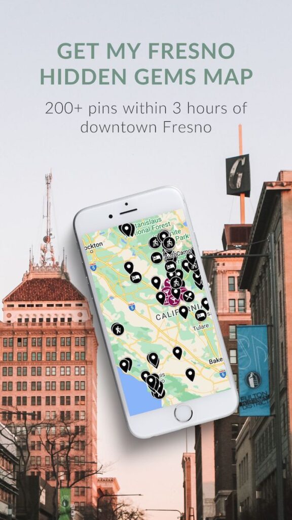
(*ps. If you want even more hikes beyond Fresno, check out my [Fresno day trips map](https://cassiescompass.com/fresno-map/) featuring over 200 pins*.)
Table of Contents
- [13 Hikes Near Fresno](https://cassiescompass.com/fresno-hikes/#13-hikes-near-fresno)
- [1\. Pincushion](https://cassiescompass.com/fresno-hikes/#1-pincushion)
- [2\. Lewis Creek Trail (Corlieu Falls)](https://cassiescompass.com/fresno-hikes/#2-lewis-creek-trail-corlieu-falls)
- [3\. Big Table Mountain via Wellbarn Road](https://cassiescompass.com/fresno-hikes/#3-big-table-mountain-via-wellbarn-road)
- [4\. Willow Creek (Angel Falls)](https://cassiescompass.com/fresno-hikes/#4-willow-creek-angel-falls)
- [5\. Pa'San Ridge](https://cassiescompass.com/fresno-hikes/#5-pasan-ridge)
- [6\. Stevenson Falls](https://cassiescompass.com/fresno-hikes/#6-stevenson-falls)
- [7\. Buzzard's Roost](https://cassiescompass.com/fresno-hikes/#7-buzzards-roost)
- [8\. Manzanita Lake](https://cassiescompass.com/fresno-hikes/#8-manzanita-lake)
- [9\. Rancheria Falls](https://cassiescompass.com/fresno-hikes/#9-rancheria-falls)
- [10\. Hensley Lake](https://cassiescompass.com/fresno-hikes/#10-hensley-lake)
- [11\. Tenaya Falls](https://cassiescompass.com/fresno-hikes/#11-tenaya-falls)
- [12\. Edison Point](https://cassiescompass.com/fresno-hikes/#12-edison-point)
- [13\. Tollhouse Rock](https://cassiescompass.com/fresno-hikes/#13-tollhouse-rock)
- [The Best Walking Trails in Fresno](https://cassiescompass.com/fresno-hikes/#the-best-walking-trails-in-fresno)
- [1\. Old Town Trail (Clovis Rail Trail)](https://cassiescompass.com/fresno-hikes/#1-old-town-trail-clovis-rail-trail)
- [2\. Dry Creek Trail](https://cassiescompass.com/fresno-hikes/#2-dry-creek-trail)
- [3\. Sugar Pine Trail (Railroad Park Trail)](https://cassiescompass.com/fresno-hikes/#3-sugar-pine-trail-railroad-park-trail)
- [4\. Woodward Park (Lewis S Eaton Trail)](https://cassiescompass.com/fresno-hikes/#4-woodward-park-lewis-s-eaton-trail)
- [5\. Lost Lakes](https://cassiescompass.com/fresno-hikes/#5-lost-lakes)
- [6\. Sycamore Island](https://cassiescompass.com/fresno-hikes/#6-sycamore-island)
- [Fresno Hiking Trails](https://cassiescompass.com/fresno-hikes/#fresno-hiking-trails)
- [Tips for Hiking Near Fresno](https://cassiescompass.com/fresno-hikes/#tips-for-hiking-near-fresno)
- [Hikes in Fresno FAQ](https://cassiescompass.com/fresno-hikes/#hikes-in-fresno-faq)
\#1 resource
[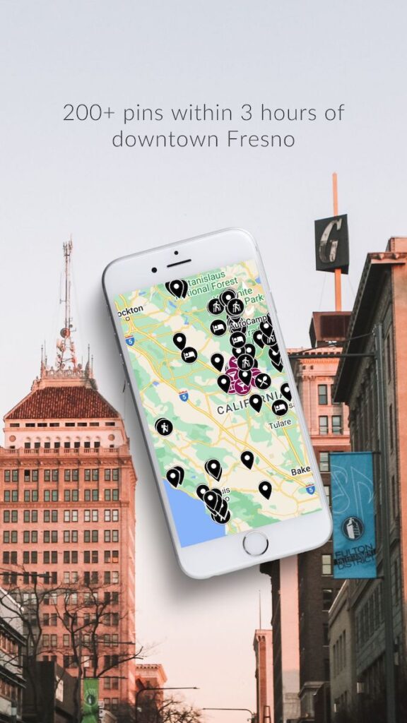](https://cassiescompass.com/fresno-map/)
### Fresno Places & Hidden Gems Map
Discover the hidden gems of Fresno with my **hand-picked collection of over 200 must-see spots**. I’ve compiled my years exploring *Fresno and its surrounding day trips* all in one place with an easy-to-use legend sorted by activity and proximity.
Download the map and get ready to discover the magic of Fresno, one pin at a time\!
[Get the Map](https://cassiescompass.com/fresno-map/)
## 13 Hikes Near Fresno
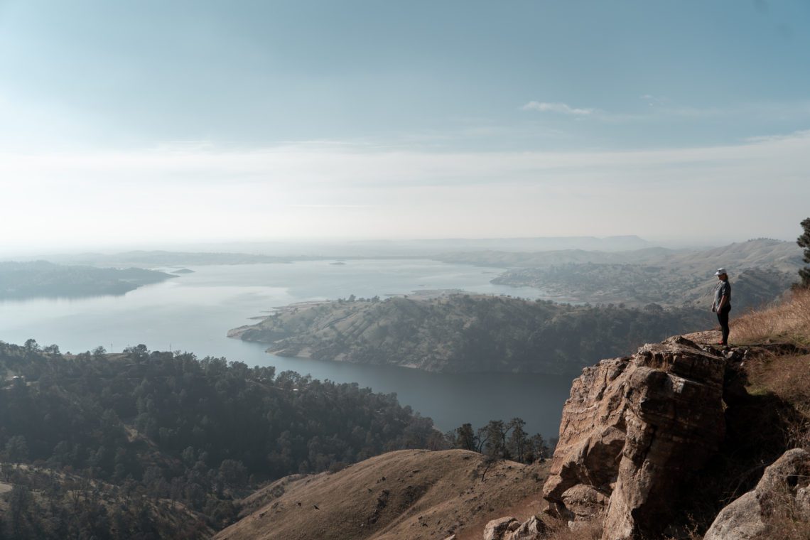
### 1\. Pincushion
*35 minutes from Fresno \| Moderate*

The view from Pincushion
Are you from Fresno if you haven’t hiked Pincushion? Nestled amidst rolling hills and oak trees, this trail offers a perfect blend of challenge and beauty. As you trek along the well-maintained paths, you’ll be treated to breathtaking views of Millerton Lake sparkling in the sunlight and the rugged terrain of the Sierra Nevada foothills.
- [AllTrails Map](https://www.alltrails.com/trail/us/california/pincushion-mountain-peak?u=i&sh=ntbfw0)
- 2\.8-mile loop
- 900-foot elevation gain
- 2-hour hike
- Minimal shade
- No Dogs
- Park at Pincushion Peak Trailhead pullout on Sky Harbour Road
### 2\. Lewis Creek Trail (Corlieu Falls)
*1 hour from Fresno \| Moderate*

Corlieu Falls at low volume
You will see the pullout for the Lewis Creek Trail [on your way to Yosemite](https://cassiescompass.com/fresno-to-yosemite/). The nice thing about this trail is the parking and trailhead are easy to find. It can be steep getting back up to the parking lot, especially if it is muddy. See Corlieu and Red Rock Falls.
- [AllTrails Map](https://www.alltrails.com/trail/us/california/lewis-creek-national-scenic-trail-to-corlieu-falls-and-red-rock-falls?u=i&sh=ntbfw0)
- 3\.8 miles out and back
- 500-foot elevation gain
- 1\.5 hour hike
- Lots of shade
- Mud and river crossing
- Dog friendly
- Park at Lewis Creek Trailhead parking lot off Highway 41
### 3\. Big Table Mountain via Wellbarn Road
*40 minutes from Fresno \| Moderate-Difficult*

Photo Credit: Diem N via AllTrails
Big Table Mountain is near Millerton and Pincushion. Follow a somewhat steep cow trail, but the hike flattens out at the top of the plateau, leading to great views of Millerton and the surrounding foothills.
- [AllTrails Map](https://www.alltrails.com/trail/us/california/wellbarn-road-trail-to-big-table-mountain?u=i&sh=ntbfw0)
- 7\.9 miles out and back
- 1700-foot elevation gain
- 4\.5 hour hike
- Minimal shade
- Dog friendly
- Park on Wellbarn Road
### 4\. Willow Creek (Angel Falls)
*1 hour from Fresno \| Moderate*

Photo Credit: Kaitlyn Sanson via AllTrails
Angel Falls is near Bass Lake. Cross a bridge that leads to the trail that will take you to Devil’s Slide and Angel Falls. You’ll be right next to the restaurants and shops at Bass if you want a snack or meal after your hike.
- [AllTrails Map](https://www.alltrails.com/trail/us/california/angle-falls-via-willow-creek-trail?u=i&sh=ntbfw0)
- 3-mile loop
- 600-foot elevation gain
- 2-hour hike
- Decent shade
- Dog friendly
- Paid parking in a turnout off Road 274
### 5\. Pa’San Ridge
*50 minutes from Fresno \| Easy-Moderate*

Photo Credit: Gavyn Tapp via AllTrails
The Pa’San Ridge Trail is north of Millerton Lake. It is best known for the San Joaquin River footbridge that you will cross towards the beginning of the hike. It is also a nice walk to the bridge and back before the loop begins if you want a shorter hike.
- [AllTrails Map](https://www.alltrails.com/trail/us/california/pasan-ridge-trail?u=i&sh=ntbfw0)
- 7\.6-mile loop
- 1200-foot elevation gain
- 4 hour hike
- Minimal shade
- Dog friendly
- Paid parking on Smalley Road
### 6\. Stevenson Falls
*1 hour from Fresno \| Easy*

Stevenson Falls in spring
Stevenson Falls is a paved fire road that leads to a waterfall right on the road. Because it is paved, it is a good hike for families and is one of the easiest waterfalls to get to near Fresno. At times of high flow, the water will come over the road and make the nearby asphalt slippery, but it is easy to avoid and see from a distance.
- [AllTrails Map](https://www.alltrails.com/trail/us/california/stevenson-falls?u=i&sh=ntbfw0)
- 7-mile out and back
- 700-foot elevation gain
- 2\.5 hour hike
- Minimal shade
- Dog friendly
- Park at Stevenson Falls trailhead
Preview the full hiking trail.
### 7\. Buzzard’s Roost
*35 minutes from Fresno \| Moderate*

Photo Credit: Mark Hernandez via AllTrails
Buzzard’s Roost is very similar to Pincushion, however it is on the opposite side of Millerton Lake. It is a short, steep scramble that leads to nice views of Millerton and the foothills. You can also see Pincushion Peak from here.
- [AllTrails Map](https://www.alltrails.com/trail/us/california/buzzard-roost-trail?u=i&sh=ntbfw0)
- 1 mile out and back
- 400-foot elevation gain
- 1\.5 hour hike
- Minimal shade
- No Dogs
- Park on the shoulder along Road 145
### 8\. Manzanita Lake
*1 hour from Fresno \| Easy*

Photo Credit: Alisa Montes via AllTrails
Manzanita Lake is an easy trail best known for the flume that you walk on for part of the trail. It is relatively flat and can be fun for kids because of the flume.
- [AllTrails Map](https://www.alltrails.com/trail/us/california/manzanita-lake-trail-north-fork?u=i&sh=ntbfw0)
- 2-mile out and back
- 100-foot elevation gain
- 1 hour hike
- Decent shade
- Dog friendly
- Park on the pullout along Road 22
### 9\. Rancheria Falls
*1\.5 hours from Fresno \| Easy*

Rancheria Falls in winter at low volume
Rancheria Falls trailhead is just past [China Peak Ski Resort](https://cassiescompass.com/california-ski-resorts-ranked-by-region/). It is an easy hike with an easy-to-follow path that leads right to the waterfall. As with most waterfalls near Fresno, is best to go in the spring or early summer if you want to see the high water flow.
- [AllTrails Map](https://www.alltrails.com/trail/us/california/rancheria-falls-trail--6?u=i&sh=ntbfw0)
- 1\.5 miles out and back
- 200-foot elevation gain
- 45-minute hike
- Decent shade
- Dog friendly
- Parking in the designated lot at the trailhead
### 10\. Hensley Lake
*50 minutes from Fresno \| Easy*–*Moderate*

Photo Credit: Cedric Pearce via AllTrails
Hensley Lake is a pretty flat trail with great views of Hensley Lake throughout, however, there can be some steep sections. This is a great place to see wildflowers in the spring.
- [AllTrails Map](https://www.alltrails.com/trail/us/california/angle-falls-via-willow-creek-trail?u=i&sh=ntbfw0)
- 4\.8-mile loop
- 500-foot elevation gain
- 2-hour hike
- No shade
- Dog friendly
- Paid Parking or America the Beautiful Parks Pass
### 11\. Tenaya Falls
*1\.25 hours from Fresno \| Easy-Moderate*

Tenaya Falls is hidden in the trails behind Tenaya Lodge. If you want, you can ask the front desk staff and they can give you pointers for where to go. You will drive past the hotel and past the horse stable until you see a pullout on the dirt road. Walk along Road 5S18 until you see a trail veer down the hill. It is a steep climb down the hill until you see the pools and waterfalls.
- [Google Maps](https://maps.app.goo.gl/dysLfKdvgrfjbruf6) (This trail is not on AllTrails)
- 1-mile out and back
- 200-foot elevation gain
- 1 hour hike
- Minimal shade
- No dogs
- Park on Big Sandy Road past Yosemite Trails Horseback riding
### 12\. Edison Point
*50 minutes from Fresno \| Easy-Moderate*

Photo Credit: Michael Bacallao via AllTrails
Edison Point is a relatively flat trail with great views of Trimmer Lake. It will be very green with lots of wildflowers, making it one of the best Fresno hiking trails if you visit in the spring.
- [AllTrails Map](https://www.alltrails.com/trail/us/california/edison-point-trail?u=i&sh=ntbfw0)
- 2-mile loop
- 300-foot elevation gain
- 1 hour hike
- No shade
- Dog friendly
- Park in the pullout on Trimmer Springs Road
### 13\. Tollhouse Rock
*40 minutes from Fresno \| Moderate*

Photo Credit: Joe Choperena via AllTrails
Tollhouse Rock is near [Shaver Lake](https://cassiescompass.com/shaver-lake-things-to-do/). Hike uphill to a view of flat granite cliffs and domes and the surrounding Sierras. Stop by Shaver and grab some monkey bread on the way home\!
- [AllTrails Map](https://www.alltrails.com/trail/us/california/tollhouse-rock-from-tollhouse-road?u=i&sh=ntbfw0)
- 3\.6 miles out and back
- 1200-foot elevation gain
- 2\.5 hour hike
- Decent shade
- Dog friendly
- Park on the small pullout on Tollhouse Road
## The Best Walking Trails in Fresno
While I wouldn’t consider these hikes, Fresno itself is home to several great walking trails that are excellent for families, bikes, and dogs. For the most part, they are protected from the roadway and are wide and well-maintained. Plus, you don’t have to leave Fresno to enjoy them.
### 1\. Old Town Trail (Clovis Rail Trail)

Aptly named, the Old Town Trail runs alongside [Old Town Clovis](https://cassiescompass.com/top-things-to-do-in-clovis-ca/). It connects to the Dry Creek, Sugar Pine, and Woodward Park Trails. Grab a [Kuppa Joy coffee](https://cassiescompass.com/best-coffee-shops-fresno/) and enjoy a pleasant walk.
- [AllTrails Map](https://www.alltrails.com/trail/us/california/old-town-clovis-trail?u=i&sh=ntbfw0)
### 2\. Dry Creek Trail
The Dry Creek Trail connects to the Old Town, Sugar Pine, and Woodward Park Trails. It runs next to the [Clovis Botanical Garden](https://cassiescompass.com/top-things-to-do-in-clovis-ca/), which is free to enter.
- [AllTrails Map](https://www.alltrails.com/trail/us/california/dry-creek-trail--4?u=i&sh=ntbfw0)
### 3\. Sugar Pine Trail (Railroad Park Trail)

The Sugar Pine Trail connects to the Dry Creek, Sugar Pine, and Woodward Park Trails. It is also known as the Railroad Park Trail as it runs through that park.
- [AllTrails Map](https://www.alltrails.com/trail/us/california/fresno-sugar-pine-trail?u=i&sh=ntbfw0)
### 4\. Woodward Park (Lewis S Eaton Trail)
Woodward Park is a popular walking and exercise area in North Fresno. You will also find the Shinzen Japanese Friendship Gardens here.
- [AllTrails Map](https://www.alltrails.com/trail/us/california/lewis-eaton-and-tom-macmichael-loop-trail?u=i&sh=ntbfw0)
### 5\. Lost Lakes
Lost Lakes is on the way to Millerton Lake. It has recreation areas for cooking and camping and is another spot for kayaking and fishing.
- [AllTrails Map](https://www.alltrails.com/trail/us/california/lost-lake-nature-trail?u=i&sh=ntbfw0)
### 6\. Sycamore Island

Sycamore Island is a hidden gem in Fresno. It has walking trails, rentable canoes, and swimming spots.
- [AllTrails Map](https://www.alltrails.com/trail/us/california/north-sycamore-island-trail?u=i&sh=ntbfw0)
## Fresno Hiking Trails
(*Want over 30 more hikes within three hours of Fresno? Check out my [Fresno day trips map](https://cassiescompass.com/fresno-map/) featuring over 200 pins*.)
## Tips for Hiking Near Fresno
We all know that Fresno is known for the heat, especially in the summer when temperatures regularly reach over 100 degrees. **Always come prepared with water**, as not many trails have potable water sources.
**You will also want sun protection** as many trails are out in the open without much shade.
Additionally, **areas near water, like Millerton or Trimmer, are known for rattlesnakes in the summer**. Be aware of your surroundings and be mindful if you have pets and children with you.
Likewise, wear appropriate footwear. My favorite hiking boots are [these ones from Forsake](https://amzn.to/3xc2pAV).
## Hikes in Fresno FAQ
**Are there mountains in Fresno?**
The City of Fresno does not have mountains. However, Fresno County includes part of the Sierra Nevada Mountains. The outskirts of Fresno are in the foothills of the Sierras.
**What is the most popular hike near Fresno?**
Pincushion is one of the most popular Fresno hikes because it is nearby, easy to access, and has stunning views of Lake Millerton.
**Are there waterfall hikes near Fresno?**
Stevenson Falls, Corlieu Falls, Angel Falls, Rancheria Falls, and Tenaya Falls are all waterfall hikes less than two hours from Fresno.
**YOU MIGHT ALSO LIKE:**
- [The Fresno Blossom Trail](https://cassiescompass.com/fresno-blossom-trail/)
- [Everything to do in Shaver Lake](https://cassiescompass.com/shaver-lake-things-to-do/)
- [The Best Stops from Fresno to Yosemite](https://cassiescompass.com/fresno-to-yosemite/)
- [Four National Parks Near Fresno](https://cassiescompass.com/national-parks-near-fresno/)
By [Cassie](https://cassiescompass.com/author/admin/ "Posts by Cassie")
#### [Cassie](https://cassiescompass.com/author/admin/ "Posts by Cassie")
For Cassie, every destination deepens her love for God. Her mission is to inspire that same love in others. Hang around and find something to inspire your next adventure\!
[](https://cassiescompass.com/teamlab-planets-vs-borderless-tokyo/ "teamLab Planets vs Borderless: Which is Better?") [](https://cassiescompass.com/is-yokohama-worth-visiting/ "Is Yokohama Worth a Day Trip? Why AND Why Not")
### You May Also Like
[](https://cassiescompass.com/los-angeles-vs-san-francisco/)
#### [Los Angeles vs. San Francisco: Which City Should You Visit?](https://cassiescompass.com/los-angeles-vs-san-francisco/)
May 7, 2023
[](https://cassiescompass.com/date-ideas-fresno/)
#### [25 Fresno Date Ideas for 2025](https://cassiescompass.com/date-ideas-fresno/)
January 14, 2025
[](https://cassiescompass.com/why-pinnacles-national-park-is-definitely-worth-visiting/)
#### [Why Pinnacles National Park is Definitely Worth Visiting](https://cassiescompass.com/why-pinnacles-national-park-is-definitely-worth-visiting/)
November 23, 2020
[](https://cassiescompass.com/about-cassie)
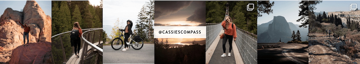
### I'm Cassie
I share adventures in Central California & beyond. Travel inspiration doesn’t have to be far to be meaningful, especially when it starts close to home.
- [Instagram](https://instagram.com/cassiescompass)
- [YouTube](https://youtube.com/@cassiescompass?si=zRBaqca39OEn7R1J)
- [TikTok](https://www.tiktok.com/@cassiescompass?lang=en)
- [Amazon](https://www.amazon.com/shop/cassiescompass)
[](https://cassiescompass.com/fresno-map/)
[](https://instagram.com/cassiescompass)
## Pages
- [About Cassie](https://cassiescompass.com/about-cassie/)
- [Christian Travel](https://cassiescompass.com/christian-travel/)
- [Contact](https://cassiescompass.com/contact/)
- [Destinations](https://cassiescompass.com/destinations/)
- [Fresno Map](https://cassiescompass.com/fresno-map/)
- [Privacy Policy](https://cassiescompass.com/privacy-policy/)
- [Subscribe](https://cassiescompass.com/subscribe/)
Mark 16:15 \| 2026 © Cassie's Compass |
| Readable Markdown | *Cassie’s Compass contains affiliate links and is also an Amazon Services LLC Associates Program member. If you make a purchase using one of these links, I may receive compensation at no extra cost to you. See my [Privacy Policy](https://cassiescompass.com/privacy-policy/) for more information.*
Are you looking for the best Fresno hikes? I’ve got you covered.
Fresno may not come to mind as a hiking mecca as we are located in the flat Central Valley of California. However, our proximity to the Sierra Nevadas puts a ton of great hiking at our fingertips.
**As a Fresno resident**, hiking is one of my favorite weekend activities.
While we all know that there are some stunning hikes in the [four nearby National Parks](https://cassiescompass.com/national-parks-near-fresno/), sometimes we don’t want to go all the way to a National Park to get some hiking in.
Many of the hikes I’ve listed hikes are less than an hour drive from downtown! If you are looking for some **new outdoor places to explore that are nearby**, then read on.
Here are 13 of my favorite hikes near Fresno, plus the best walking trails in Fresno.
(*ps. If you want even more hikes beyond Fresno, check out my [Fresno day trips map](https://cassiescompass.com/fresno-map/) featuring over 200 pins*.)
\#1 resource
[](https://cassiescompass.com/fresno-map/)
### Fresno Places & Hidden Gems Map
Discover the hidden gems of Fresno with my **hand-picked collection of over 200 must-see spots**. I’ve compiled my years exploring *Fresno and its surrounding day trips* all in one place with an easy-to-use legend sorted by activity and proximity.
Download the map and get ready to discover the magic of Fresno, one pin at a time\!
### 1\. Pincushion
*35 minutes from Fresno \| Moderate*

The view from Pincushion
Are you from Fresno if you haven’t hiked Pincushion? Nestled amidst rolling hills and oak trees, this trail offers a perfect blend of challenge and beauty. As you trek along the well-maintained paths, you’ll be treated to breathtaking views of Millerton Lake sparkling in the sunlight and the rugged terrain of the Sierra Nevada foothills.
- [AllTrails Map](https://www.alltrails.com/trail/us/california/pincushion-mountain-peak?u=i&sh=ntbfw0)
- 2\.8-mile loop
- 900-foot elevation gain
- 2-hour hike
- Minimal shade
- No Dogs
- Park at Pincushion Peak Trailhead pullout on Sky Harbour Road
### 2\. Lewis Creek Trail (Corlieu Falls)
*1 hour from Fresno \| Moderate*

Corlieu Falls at low volume
You will see the pullout for the Lewis Creek Trail [on your way to Yosemite](https://cassiescompass.com/fresno-to-yosemite/). The nice thing about this trail is the parking and trailhead are easy to find. It can be steep getting back up to the parking lot, especially if it is muddy. See Corlieu and Red Rock Falls.
- [AllTrails Map](https://www.alltrails.com/trail/us/california/lewis-creek-national-scenic-trail-to-corlieu-falls-and-red-rock-falls?u=i&sh=ntbfw0)
- 3\.8 miles out and back
- 500-foot elevation gain
- 1\.5 hour hike
- Lots of shade
- Mud and river crossing
- Dog friendly
- Park at Lewis Creek Trailhead parking lot off Highway 41
### 3\. Big Table Mountain via Wellbarn Road
*40 minutes from Fresno \| Moderate-Difficult*

Photo Credit: Diem N via AllTrails
Big Table Mountain is near Millerton and Pincushion. Follow a somewhat steep cow trail, but the hike flattens out at the top of the plateau, leading to great views of Millerton and the surrounding foothills.
- [AllTrails Map](https://www.alltrails.com/trail/us/california/wellbarn-road-trail-to-big-table-mountain?u=i&sh=ntbfw0)
- 7\.9 miles out and back
- 1700-foot elevation gain
- 4\.5 hour hike
- Minimal shade
- Dog friendly
- Park on Wellbarn Road
### 4\. Willow Creek (Angel Falls)
*1 hour from Fresno \| Moderate*

Photo Credit: Kaitlyn Sanson via AllTrails
Angel Falls is near Bass Lake. Cross a bridge that leads to the trail that will take you to Devil’s Slide and Angel Falls. You’ll be right next to the restaurants and shops at Bass if you want a snack or meal after your hike.
- [AllTrails Map](https://www.alltrails.com/trail/us/california/angle-falls-via-willow-creek-trail?u=i&sh=ntbfw0)
- 3-mile loop
- 600-foot elevation gain
- 2-hour hike
- Decent shade
- Dog friendly
- Paid parking in a turnout off Road 274
### 5\. Pa’San Ridge
*50 minutes from Fresno \| Easy-Moderate*

Photo Credit: Gavyn Tapp via AllTrails
The Pa’San Ridge Trail is north of Millerton Lake. It is best known for the San Joaquin River footbridge that you will cross towards the beginning of the hike. It is also a nice walk to the bridge and back before the loop begins if you want a shorter hike.
- [AllTrails Map](https://www.alltrails.com/trail/us/california/pasan-ridge-trail?u=i&sh=ntbfw0)
- 7\.6-mile loop
- 1200-foot elevation gain
- 4 hour hike
- Minimal shade
- Dog friendly
- Paid parking on Smalley Road
### 6\. Stevenson Falls
*1 hour from Fresno \| Easy*

Stevenson Falls in spring
Stevenson Falls is a paved fire road that leads to a waterfall right on the road. Because it is paved, it is a good hike for families and is one of the easiest waterfalls to get to near Fresno. At times of high flow, the water will come over the road and make the nearby asphalt slippery, but it is easy to avoid and see from a distance.
- [AllTrails Map](https://www.alltrails.com/trail/us/california/stevenson-falls?u=i&sh=ntbfw0)
- 7-mile out and back
- 700-foot elevation gain
- 2\.5 hour hike
- Minimal shade
- Dog friendly
- Park at Stevenson Falls trailhead
Preview the full hiking trail.
### 7\. Buzzard’s Roost
*35 minutes from Fresno \| Moderate*

Photo Credit: Mark Hernandez via AllTrails
Buzzard’s Roost is very similar to Pincushion, however it is on the opposite side of Millerton Lake. It is a short, steep scramble that leads to nice views of Millerton and the foothills. You can also see Pincushion Peak from here.
- [AllTrails Map](https://www.alltrails.com/trail/us/california/buzzard-roost-trail?u=i&sh=ntbfw0)
- 1 mile out and back
- 400-foot elevation gain
- 1\.5 hour hike
- Minimal shade
- No Dogs
- Park on the shoulder along Road 145
### 8\. Manzanita Lake
*1 hour from Fresno \| Easy*

Photo Credit: Alisa Montes via AllTrails
Manzanita Lake is an easy trail best known for the flume that you walk on for part of the trail. It is relatively flat and can be fun for kids because of the flume.
- [AllTrails Map](https://www.alltrails.com/trail/us/california/manzanita-lake-trail-north-fork?u=i&sh=ntbfw0)
- 2-mile out and back
- 100-foot elevation gain
- 1 hour hike
- Decent shade
- Dog friendly
- Park on the pullout along Road 22
### 9\. Rancheria Falls
*1\.5 hours from Fresno \| Easy*

Rancheria Falls in winter at low volume
Rancheria Falls trailhead is just past [China Peak Ski Resort](https://cassiescompass.com/california-ski-resorts-ranked-by-region/). It is an easy hike with an easy-to-follow path that leads right to the waterfall. As with most waterfalls near Fresno, is best to go in the spring or early summer if you want to see the high water flow.
- [AllTrails Map](https://www.alltrails.com/trail/us/california/rancheria-falls-trail--6?u=i&sh=ntbfw0)
- 1\.5 miles out and back
- 200-foot elevation gain
- 45-minute hike
- Decent shade
- Dog friendly
- Parking in the designated lot at the trailhead
### 10\. Hensley Lake
*50 minutes from Fresno \| Easy*–*Moderate*

Photo Credit: Cedric Pearce via AllTrails
Hensley Lake is a pretty flat trail with great views of Hensley Lake throughout, however, there can be some steep sections. This is a great place to see wildflowers in the spring.
- [AllTrails Map](https://www.alltrails.com/trail/us/california/angle-falls-via-willow-creek-trail?u=i&sh=ntbfw0)
- 4\.8-mile loop
- 500-foot elevation gain
- 2-hour hike
- No shade
- Dog friendly
- Paid Parking or America the Beautiful Parks Pass
### 11\. Tenaya Falls
*1\.25 hours from Fresno \| Easy-Moderate*

Tenaya Falls is hidden in the trails behind Tenaya Lodge. If you want, you can ask the front desk staff and they can give you pointers for where to go. You will drive past the hotel and past the horse stable until you see a pullout on the dirt road. Walk along Road 5S18 until you see a trail veer down the hill. It is a steep climb down the hill until you see the pools and waterfalls.
- [Google Maps](https://maps.app.goo.gl/dysLfKdvgrfjbruf6) (This trail is not on AllTrails)
- 1-mile out and back
- 200-foot elevation gain
- 1 hour hike
- Minimal shade
- No dogs
- Park on Big Sandy Road past Yosemite Trails Horseback riding
### 12\. Edison Point
*50 minutes from Fresno \| Easy-Moderate*

Photo Credit: Michael Bacallao via AllTrails
Edison Point is a relatively flat trail with great views of Trimmer Lake. It will be very green with lots of wildflowers, making it one of the best Fresno hiking trails if you visit in the spring.
- [AllTrails Map](https://www.alltrails.com/trail/us/california/edison-point-trail?u=i&sh=ntbfw0)
- 2-mile loop
- 300-foot elevation gain
- 1 hour hike
- No shade
- Dog friendly
- Park in the pullout on Trimmer Springs Road
### 13\. Tollhouse Rock
*40 minutes from Fresno \| Moderate*

Photo Credit: Joe Choperena via AllTrails
Tollhouse Rock is near [Shaver Lake](https://cassiescompass.com/shaver-lake-things-to-do/). Hike uphill to a view of flat granite cliffs and domes and the surrounding Sierras. Stop by Shaver and grab some monkey bread on the way home\!
- [AllTrails Map](https://www.alltrails.com/trail/us/california/tollhouse-rock-from-tollhouse-road?u=i&sh=ntbfw0)
- 3\.6 miles out and back
- 1200-foot elevation gain
- 2\.5 hour hike
- Decent shade
- Dog friendly
- Park on the small pullout on Tollhouse Road
## The Best Walking Trails in Fresno
While I wouldn’t consider these hikes, Fresno itself is home to several great walking trails that are excellent for families, bikes, and dogs. For the most part, they are protected from the roadway and are wide and well-maintained. Plus, you don’t have to leave Fresno to enjoy them.
### 1\. Old Town Trail (Clovis Rail Trail)

Aptly named, the Old Town Trail runs alongside [Old Town Clovis](https://cassiescompass.com/top-things-to-do-in-clovis-ca/). It connects to the Dry Creek, Sugar Pine, and Woodward Park Trails. Grab a [Kuppa Joy coffee](https://cassiescompass.com/best-coffee-shops-fresno/) and enjoy a pleasant walk.
- [AllTrails Map](https://www.alltrails.com/trail/us/california/old-town-clovis-trail?u=i&sh=ntbfw0)
### 2\. Dry Creek Trail
The Dry Creek Trail connects to the Old Town, Sugar Pine, and Woodward Park Trails. It runs next to the [Clovis Botanical Garden](https://cassiescompass.com/top-things-to-do-in-clovis-ca/), which is free to enter.
- [AllTrails Map](https://www.alltrails.com/trail/us/california/dry-creek-trail--4?u=i&sh=ntbfw0)
### 3\. Sugar Pine Trail (Railroad Park Trail)

The Sugar Pine Trail connects to the Dry Creek, Sugar Pine, and Woodward Park Trails. It is also known as the Railroad Park Trail as it runs through that park.
- [AllTrails Map](https://www.alltrails.com/trail/us/california/fresno-sugar-pine-trail?u=i&sh=ntbfw0)
### 4\. Woodward Park (Lewis S Eaton Trail)
Woodward Park is a popular walking and exercise area in North Fresno. You will also find the Shinzen Japanese Friendship Gardens here.
- [AllTrails Map](https://www.alltrails.com/trail/us/california/lewis-eaton-and-tom-macmichael-loop-trail?u=i&sh=ntbfw0)
### 5\. Lost Lakes
Lost Lakes is on the way to Millerton Lake. It has recreation areas for cooking and camping and is another spot for kayaking and fishing.
- [AllTrails Map](https://www.alltrails.com/trail/us/california/lost-lake-nature-trail?u=i&sh=ntbfw0)
### 6\. Sycamore Island

Sycamore Island is a hidden gem in Fresno. It has walking trails, rentable canoes, and swimming spots.
- [AllTrails Map](https://www.alltrails.com/trail/us/california/north-sycamore-island-trail?u=i&sh=ntbfw0)
## Fresno Hiking Trails
(*Want over 30 more hikes within three hours of Fresno? Check out my [Fresno day trips map](https://cassiescompass.com/fresno-map/) featuring over 200 pins*.)
## Tips for Hiking Near Fresno
We all know that Fresno is known for the heat, especially in the summer when temperatures regularly reach over 100 degrees. **Always come prepared with water**, as not many trails have potable water sources.
**You will also want sun protection** as many trails are out in the open without much shade.
Additionally, **areas near water, like Millerton or Trimmer, are known for rattlesnakes in the summer**. Be aware of your surroundings and be mindful if you have pets and children with you.
Likewise, wear appropriate footwear. My favorite hiking boots are [these ones from Forsake](https://amzn.to/3xc2pAV).
## Hikes in Fresno FAQ
**Are there mountains in Fresno?**
The City of Fresno does not have mountains. However, Fresno County includes part of the Sierra Nevada Mountains. The outskirts of Fresno are in the foothills of the Sierras.
**What is the most popular hike near Fresno?**
Pincushion is one of the most popular Fresno hikes because it is nearby, easy to access, and has stunning views of Lake Millerton.
**Are there waterfall hikes near Fresno?**
Stevenson Falls, Corlieu Falls, Angel Falls, Rancheria Falls, and Tenaya Falls are all waterfall hikes less than two hours from Fresno.
**YOU MIGHT ALSO LIKE:**
- [The Fresno Blossom Trail](https://cassiescompass.com/fresno-blossom-trail/)
- [Everything to do in Shaver Lake](https://cassiescompass.com/shaver-lake-things-to-do/)
- [The Best Stops from Fresno to Yosemite](https://cassiescompass.com/fresno-to-yosemite/)
- [Four National Parks Near Fresno](https://cassiescompass.com/national-parks-near-fresno/) |
| Shard | 170 (laksa) |
| Root Hash | 528108364061450570 |
| Unparsed URL | com,cassiescompass!/fresno-hikes/ s443 |